Article
3 June 2026
Ten years after one of the most severe dieback events of mangroves ever recorded, surveys are shedding new light on how mangroves in the Gulf of Carpentaria are coping.
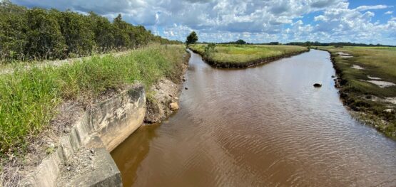
In September and November 2025, researchers returned to six long-term monitoring sites across the Gulf of Carpentaria. These sites were first measured in 2018, following the widespread mangrove loss in 2015. The team remeasured mangrove field transects to re-evaluate the condition of mangrove shoreline vegetation and to track recovery and changes in sediment levels. These on-ground measurements combined with aerial surveys and satellite mapping are building a detailed, region-wide view of the recovery of vegetation structure and overall habitat condition.
Early findings show a mixed picture. Some areas are recovering, but progress is slow. Regrowth is likely to take decades for full recovery, if at all. Ongoing pressures such as severe cyclones, heavy flooding, and rapidly rising sea levels continue to affect these mangrove-fringed shorelines. In some locations, surviving seaward stands have played a vital role in helping stabilise shorelines and supporting more rapid re-establishment of young mangroves. Where these frontline trees were lost, erosion with shoreline retreat has been more severe and recovery slower, as seaward mangroves provide valuable buffering and stability against waves and wind.
“Ten years on, we see signs of recovery, but the system is still under pressure. These follow-up surveys are critical for our understanding of how mangroves have responded over the longer term. The rate of recovery appears to be set back depending on both past damage levels and ongoing environmental stresses.”
Project leader Professor Norm Duke of James Cook University
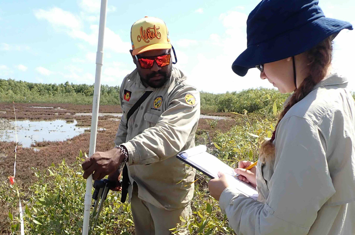 Taking detailed measurements of mangrove vegetation and regrowth with local rangers from the Mabunji Aboriginal Corporation based in Borroloola, NT. The JCU team is leading an evaluation of mangrove shorelines in the Gulf of Carpentaria damaged 10 years earlier during the 2015 El Nino extremely low sea level event. Image: NC Duke.
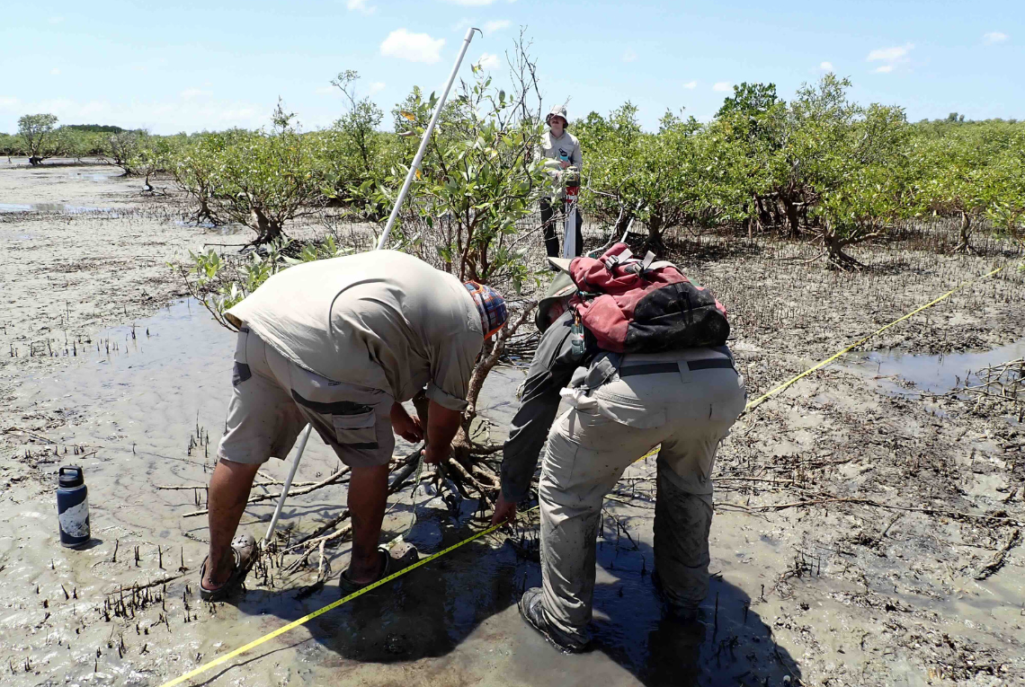 Checking newly deposited sediment levels under surviving and recently dead trees with local rangers from the Mabunji Aboriginal Corporation, as part of JCU’s 10 years after assessment of Gulf of Carpentaria shorelines damaged during the extreme 2015 El Nino low sea level event. Image: G Thomson-Saud.
The hub project, led by James Cook University’s (JCU) TropWATER, is also examining how these changes might have affected the benefits of key ecosystem services. Such benefits include fisheries productivity, shoreline protection and carbon sequestration and storage. Work is under way to compare conditions before and after 2015, including changes in commercial fish catches, and carbon stock changes across the region.
To better appreciate the significance of these findings, it is important also to look back at the event that triggered these changes. In late 2015, more than 7,000 hectares of mangroves died along over 1,000 kilometres of coastline in the southern Gulf of Carpentaria. The scale of the dieback was unprecedented.
The cause was a combination of extreme climatic conditions manifest during an extreme El Niño event that led to unusual, extremely low sea levels, dropping by nearly half a metre for six months during the dry season. Such an occurrence had never been recorded before. At the same time, the region experienced severe drought and record-high temperatures. These factors placed intense stress on mangroves, especially those growing at the upper edge of the shoreline mangrove zone across north and western Australia. Without regular tidal wetting, large areas of mangrove trees dried out, and died from the lack of moisture.
“The mangroves died of thirst,” Professor Duke says.
Losses beyond the mangroves
The extensive and severe dieback is likely also to have disrupted key ecosystem services. The dead trees were unable to protect shorelines from waves and storms, nor provide habitat for fish and other marine life, nor store carbon in both their biomass and underlying soils. The working hypothesis of the project team has been that the loss of the mangroves affected biodiversity, coastal stability and local fisheries. The evidence gathered so far appears to support that view.
With this project, the research team also identified mangrove damage linked to an earlier opposite phase of the El Niño-Southern Oscillation (ENSO), known as La Niña. In 2011, a La Niña of unusually high intensity led to unusually extreme high sea levels that also affected mangroves on this occasion at the seaward edge. This contrasts with the 2015 event, which had affected inland edges of shoreline mangrove zones. These findings demonstrate how extremes in ENSO have affected different parts of mangrove ecosystems.
“Events like those in 2015 highlight the sensitivity of mangroves to changes in sea level. Not all mangroves respond the same way. Where and how they grow shapes how they are affected by such extreme events. Understanding these patterns helps guide more considered management and future planning.”
Professor Norm Duke
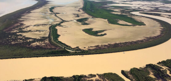
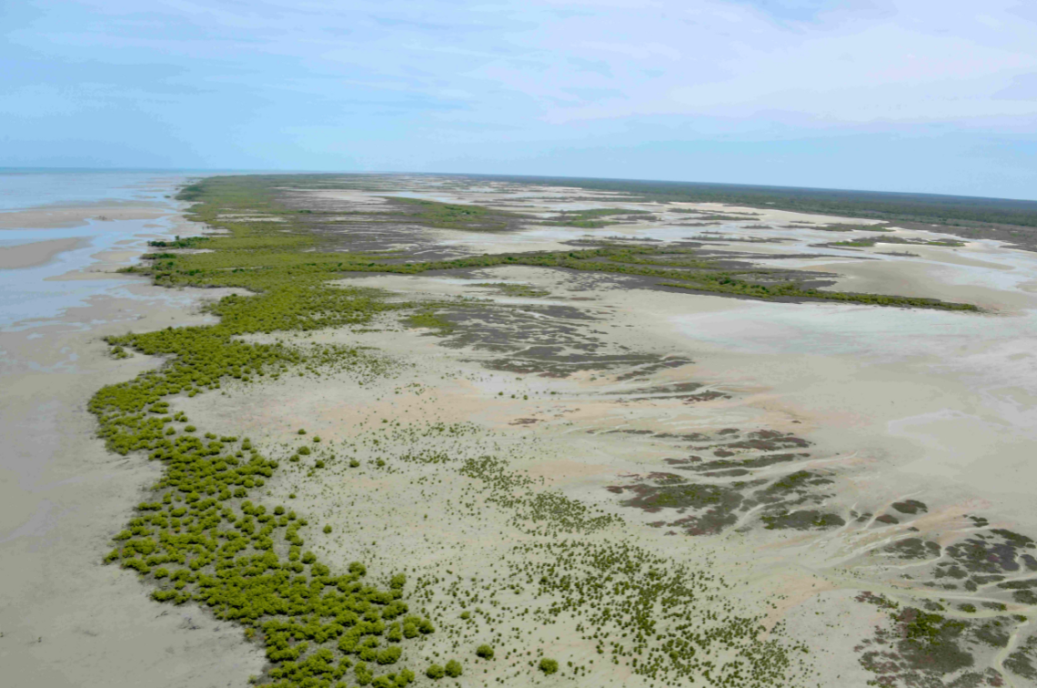 Aerial surveys identified delayed recovery and erosion of shoreline sections lacking mature sea edge survivor trees along Gulf of Carpentaria shorelines damaged during the 2015 El Nino extremely low sea level event. Image: NC Duke.
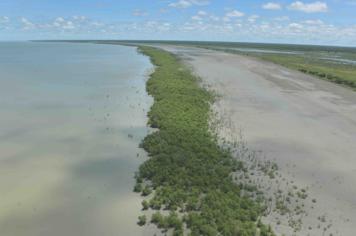 Aerial surveys identified recovering shoreline sections were aided by surviving sea edge trees in the Gulf of Carpentaria damaged during the extreme 2015 El Nino low sea level event. Image: NC Duke.
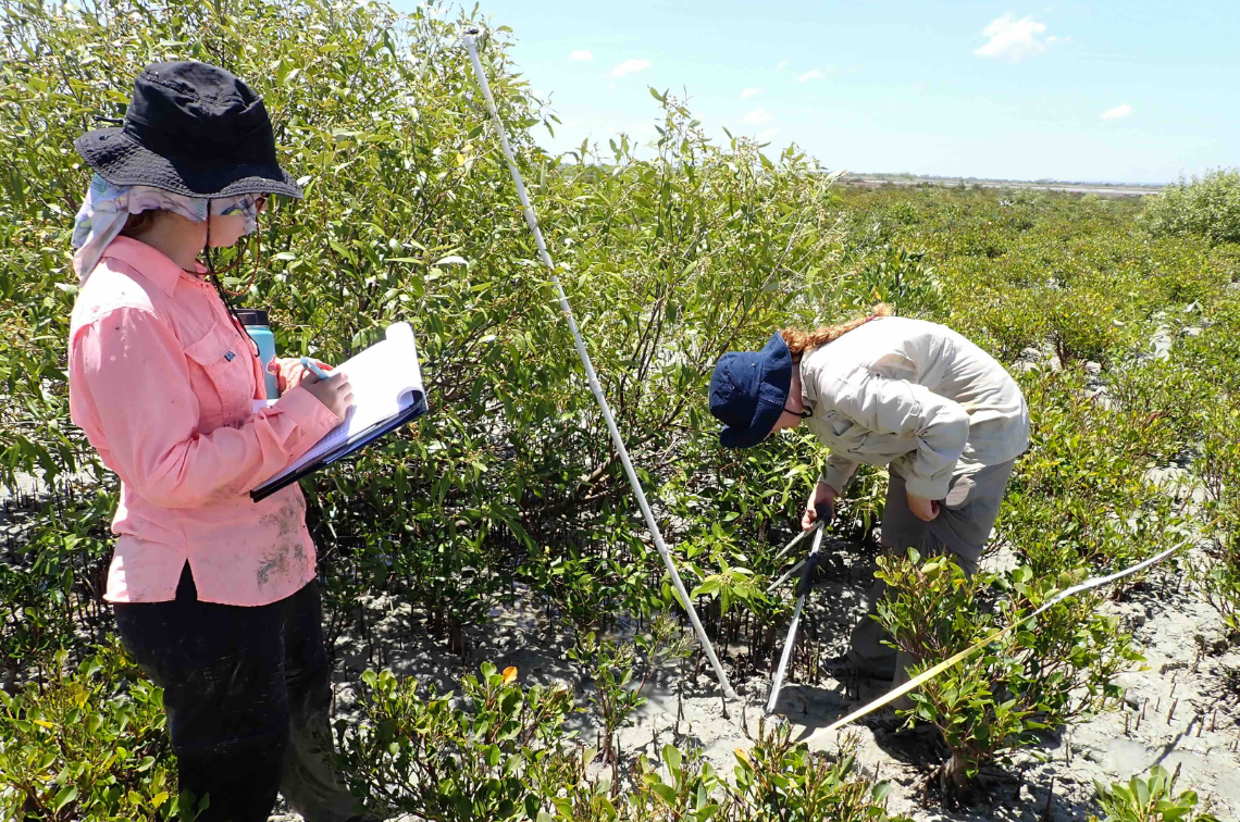 The JCU team measuring recovering mangrove vegetation in the Gulf of Carpentaria severely damaged in 2015. Image: NC Duke.
A decade after the dieback, the emerging picture is complex, but the project is helping by increasing our understanding of how mangrove systems respond to climate extremes. As the project continues, the integration of field data, aerial imagery and satellite analysis will provide a more complete picture of changes across the gulf and northern Australia. This new evidence will support and target future decisions on conservation, rehabilitation and climate adaptation, with informed ways to protect valuable shorelines, and one of Australia’s most important coastal ecosystems into the future.
Related stories
Article
A new method to identify sites for coastal wetland restoration
Article
Australia’s first living shorelines database showcases nature-based solutions to coastal hazards
Article
Catchment development in northern Australia may pose risks to coastal and marine ecosystems
More stories