Article
3 June 2026
Large volumes of marine research data are held by Australia's national institutions and programs, but not always in a form suitable for use in national assessments such as State of the Environment reporting, environmental approvals, or economic accounting. This can lead to delays, duplication, and missed opportunities for informed decision-making; an issue highlighted in the 2020 Independent Review of the EPBC Act (the Samuel Review).
A hub project is delivering new tools that make Australia’s marine data easier to use in environmental decision-making and reporting. The project has responded directly to the issue described above by developing data pipelines to transform complex research datasets into consistent, accessible and ‘assessment-ready' products that can support reporting, planning and policy.
This work draws on datasets sourced from multiple repositories, which are then harmonised, transformed, and made publicly accessible through the world-class national infrastructure provided by the Integrated Marine Observing System (IMOS) and the Australian Ocean Data Network (AODN). However, turning this data into ready-to-use information for processes such as State of the Environment reporting or environmental approvals requires additional steps, including aggregation, quality control and standardisation.
“We see this as a really exciting project given the impetus provided by the Independent Review of the EPBC Act and the Sustainable Ocean Plan. By combining the strengths of IMOS, AODN and NESP, we can provide decision makers with better information, faster – exactly what’s needed in response to rapid changes in the marine environment.”
Independent Chair of the Marine and Coastal Hub Steering Committee, Adjunct Professor Tim Moltmann of the University of Tasmania
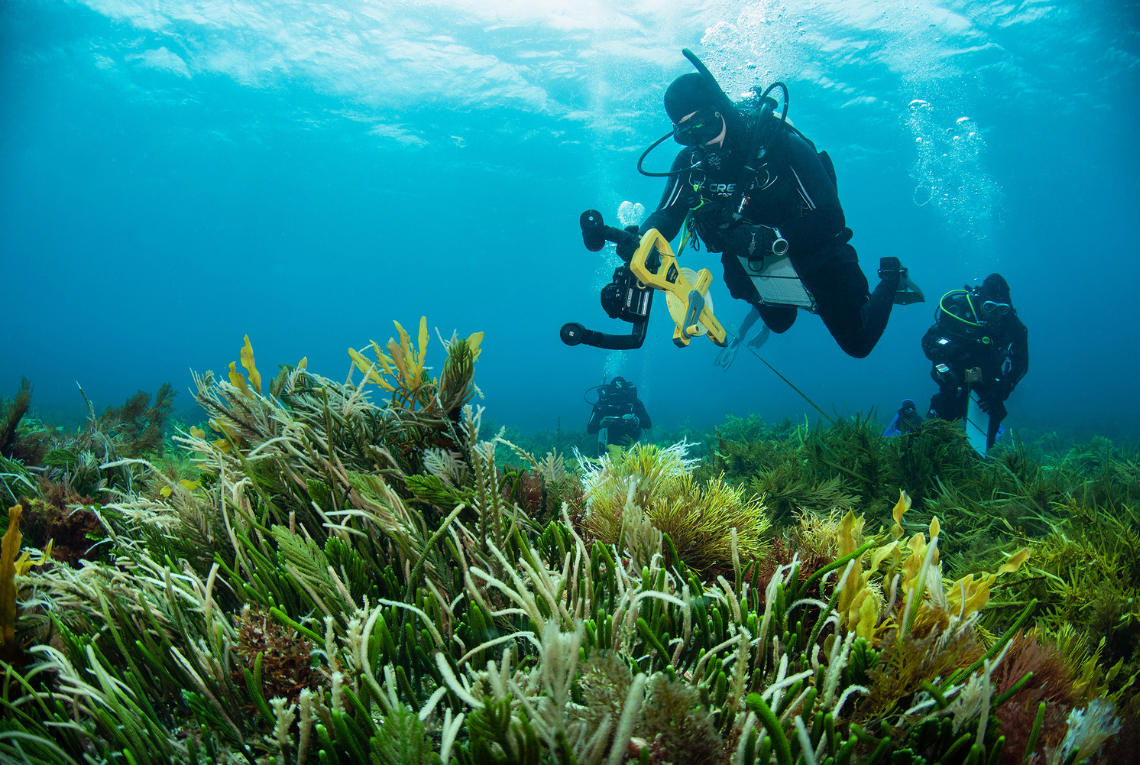
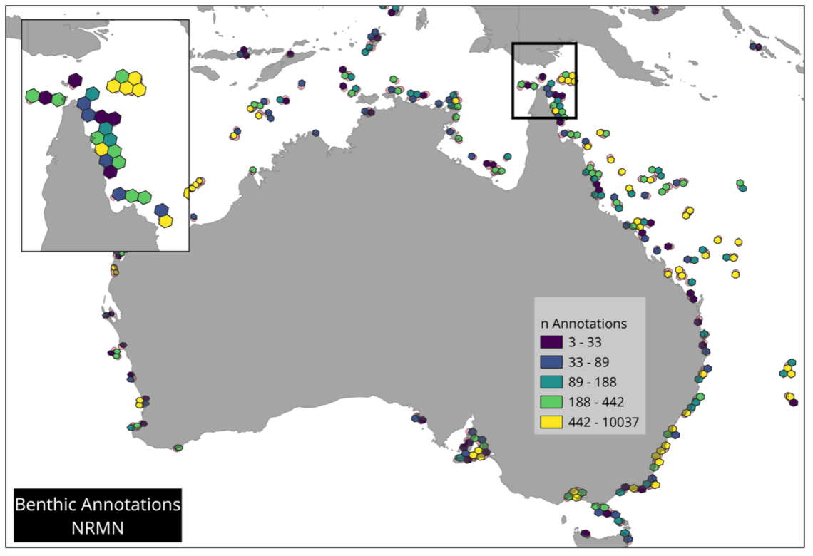
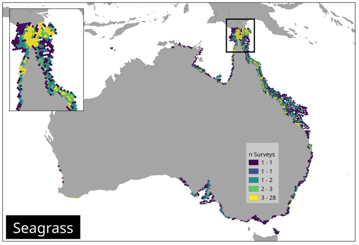
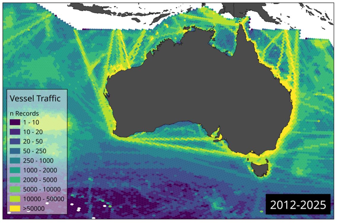
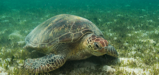
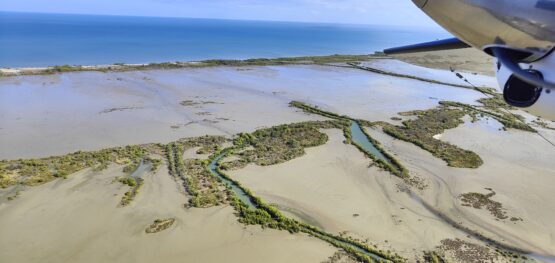
A key part of the project was identifying which datasets would deliver the greatest benefit. These datasets were selected through a national workshop with government, research and industry partners. The aim was to identify datasets that were both useful for decision-making and ready to be developed within the project timeframe. The final selection of six data sets covers key aspects of the marine environment, including habitats, species and human pressures. These include a national seagrass dataset, seabird and kelp observations, reef benthic surveys, dugong aerial surveys and vessel tracking data.
The seagrass dataset brings together more than 80 individual datasets collected over several decades. It provides national coverage and supports monitoring of habitat condition and change.
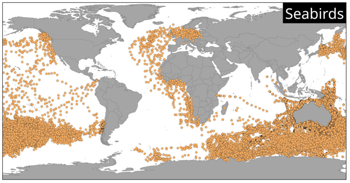
The seabird dataset combines more than 120K records from 41 datasets from the Ocean Biodiversity Information System Australis, OBIA-AU, including surveys, tracking studies and historical observations. It supports conservation planning and species assessments across large regions.
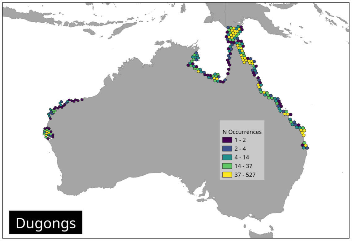
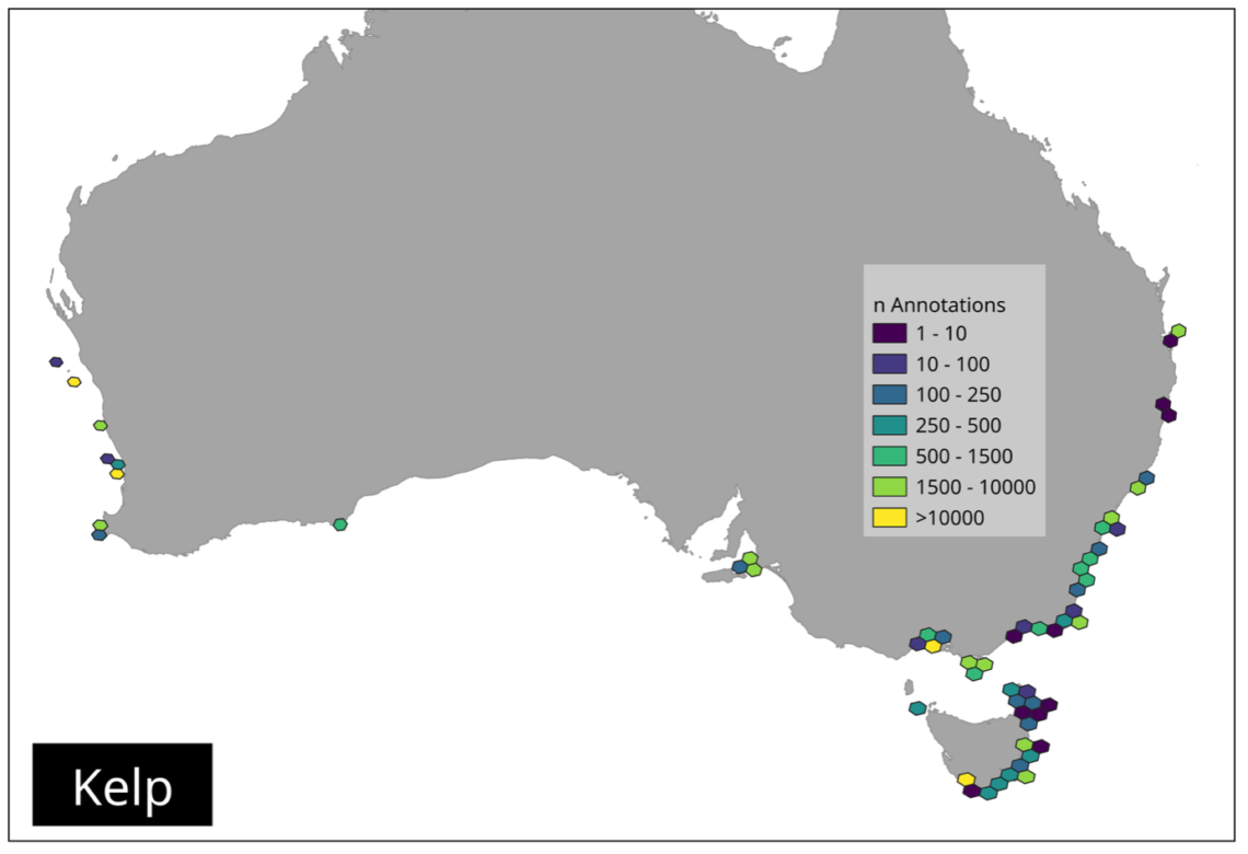
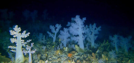
Other datasets focus on key ecosystems and pressures. Kelp and reef benthos data help track changes in marine habitats. Dugong survey data support threatened species management. Vessel tracking data reveals patterns of human activity, with over 200 million records documenting shipping movements.
“These datasets were chosen because they cover the main areas needed for marine assessment, including habitats, species and pressures. As the datasets are built within the national data infrastructure, they are automatically updated as new data becomes available. This ensures that these products remain relevant for future reporting cycles and ongoing management needs.”
Project leader Dr Eduardo Klein-Salas of IMOS
Importantly, the project does not create new data. Instead, it improves how existing data are organised and delivered. This includes aligning datasets to common standards, linking them to national systems, and making them accessible through efficient cloud-optimised formats. Each dataset was enriched by adding tags identifying the marine region where the record is located, simplifying filtering operations. Also, an H3 spatial index was added to each record, so the user can create aggregations using a standardised grid at different resolutions.
To further improve accessibility and facilitate the use of these products, AODN data engineers have developed a suite of notebooks showcasing the analytical workflows for each dataset. Companion videos guide users through the notebooks, explaining the necessary steps and expected outputs, lowering the barrier for researchers, analysts and policymakers to work confidently with the data.
As the project wraps up, it leaves a strong foundation for future work. It demonstrates how targeted investment in data infrastructure can unlock the full value of existing research and support better decisions and reporting for Australia’s coasts and oceans.
The maps below provide an overview of the selected datasets covering key aspects of the marine environment, including habitats, species, and human pressures. These datasets include a national seagrass mapping, seabird and kelp observations, reef benthic surveys, dugong aerial surveys and vessel tracking data.
Further information
- To start working with the datasets, see the NESP 5.9 Analysis Notebooks on Github and explanatory videos on the IMOS Youtube channel.
- IMOS is enabled by the National Collaborative Research Infrastructure Strategy (NCRIS).
Related stories
Article
A century of shared seagrass data strengthens Sea Country management across northern Australia
Media release
Dugong survey reveals thriving population in far north Queensland
Article
Not all reefs are rocky: new map sharpens focus on functional reefs across southern Australia
More stories