Article
18 November 2026
A Marine and Coastal Hub project has documented the remarkable scale, complexity and carbon storage capacity of seagrass habitat at the Furneaux Islands in north-eastern Lutruwita/Tasmania.
The project was led by the Tasmanian Aboriginal Centre, the Institute for Marine and Antartcic Studies at University of Tasmania, and Deakin University. Its findings support seagrass protection and management around Flinders Island, Clark Island and Cape Barren Islands, which lie within the proposed Tayaritja Wukalina milaythina muka Indigenous Protected Area (IPA).
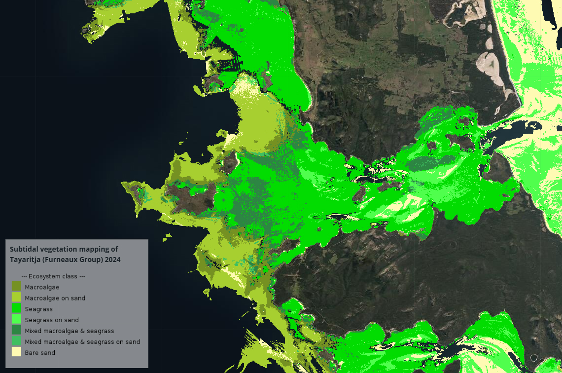
The project team mapped 1,539 square kilometres of seafloor habitat in detail, revealing 755.8 km2 of seagrass beds with an estimated below-ground organic carbon store of nine million tonnes. This makes the Furneaux Islands one of the largest known regions of intact temperate seagrass in Australia.
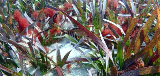
Intertidal surveys guided by the habitat mapping explored the species composition and structural complexity of seagrass beds, their diverse epiphyte and mollusc communities, and genetic patterns that underpin the viability of seagrass populations.
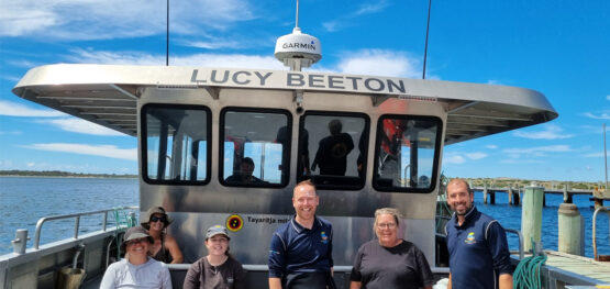
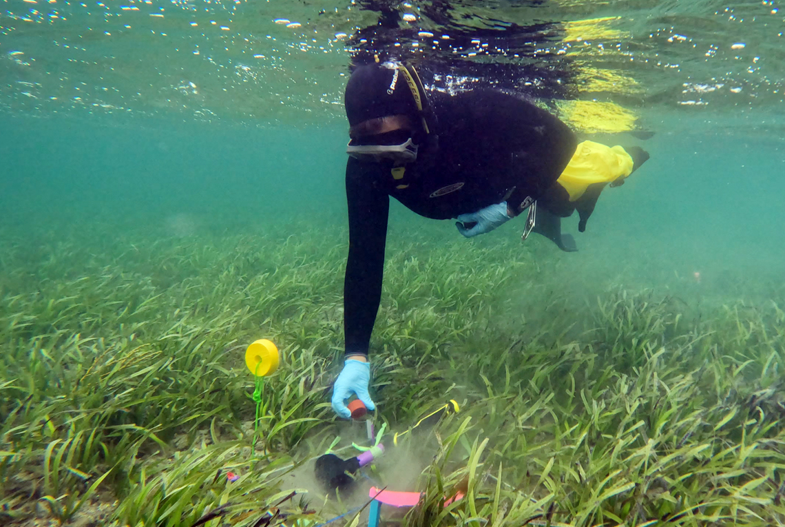
Aboriginal knowledge, cultural values and community priorities were integrated throughout the project. Pakana Rangers facilitated and participated in the field surveys, and received training in monitoring techniques while helping to develop culturally appropriate protocols for monitoring Sea Country.
Looking through many lenses
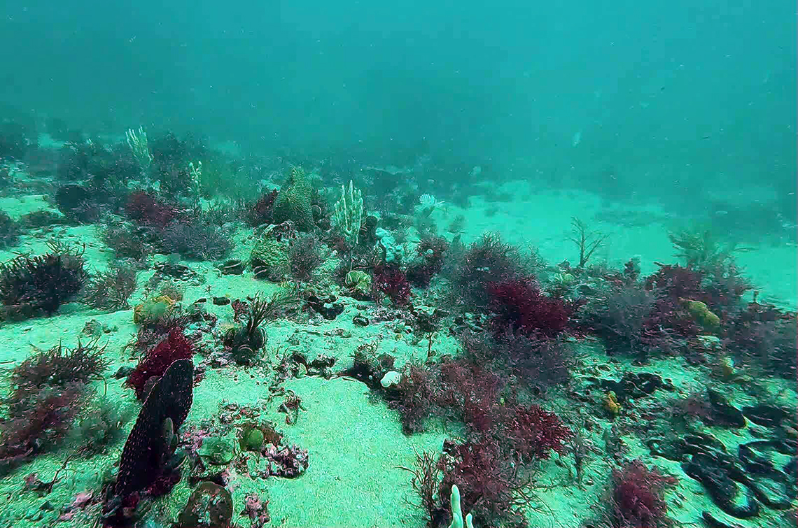
Coarse-scale surveys in the 1990s estimated the Furneaux Island seagrass beds to be deep and extensive, covering at least 500 km2 to depths of 25 metres. This hub project developed an innovative machine-learning approach that combined remotely sensed data (satellite imagery and bathymetric LiDAR) and field surveys to map seafloor habitat with greater precision and into deeper waters.
The field surveys used the Benthic Observation Survey System, an underwater camera platform that captures a panoramic view of the seafloor. Almost 400 sites were surveyed across the islands’ western and southern waters, including at the Logan Lagoon Ramsar site.
The underwater imagery was classified into different habitat types and used to train and validate models that help to interpret the remotely sensed data. This allowed the team to predict and map where different habitats were likely to occur across the study area. Seagrass habitat was identified across one third of the subtidal area to a depth of 30 m. Other habitat types included bare sand, macroalgal beds, and sponge gardens in deeper waters further from the shore.
In association with this work, a standard operating procedure was developed for mapping temperate seagrass using optical remote sensing. This provides a consistent, repeatable methodology that can be applied in future studies, enhancing national capacity for seagrass monitoring.
Measuring molluscs
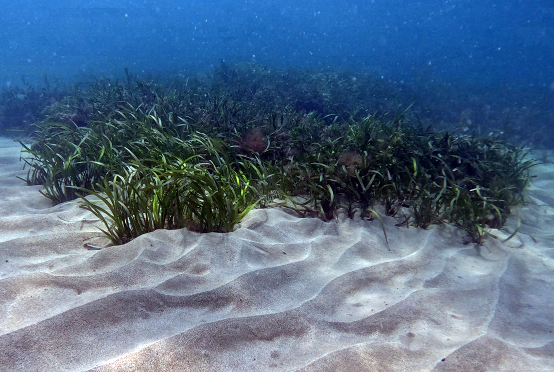
Additional field surveys explored relationships between the islands’ dominant seagrasses and the rich invertebrate communities they support. Molluscs were of particular interest because their sensitivity to environmental change makes them a possible target for monitoring. They are also highly valued by the Palawa (Tasmanian Aboriginal people) because some mollusc species that live on the seagrass are used in the cultural practice of shell stringing.
In wading and snorkel surveys, the project team sampled three seagrass species (Amphibolis antarctica, Posidonia australis and Heterozostera nigricaulis) at five sites selected in collaboration with Pakana Rangers. They also measured mollusc abundance, species richness, biomass and productivity.
The surveys recorded 657 individual molluscs representing 15 taxa. Larger and more productive seagrass beds generally had greater mollusc abundance and species richness, although this varied between species and locations. Dense P. australis beds had especially high mollusc diversity and biomass: a sign of healthy, functioning ecosystems.
Epiphytes such as algae and other organisms that grow on the seagrass leaves add habitat complexity and provide food for grazing molluscs. They have a strong influence on mollusc abundance, richness, and productivity. Variation evident in the relationships between epiphyte and mollusc communities further highlighted the complex ecological interactions within these seagrass habitats.
Genetics insights into resilience
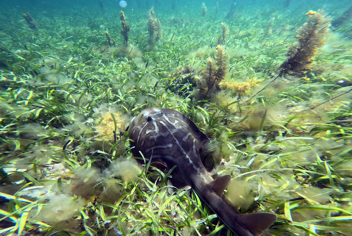
The genetic diversity and connectivity of four seagrass species was examined to better understand their resilience to environmental change. Analysis of 466 samples collected at eight sites revealed variable levels of genotypic and genetic diversity, and significant levels of genetic structure. Sites varied from being highly clonal (all samples belonging to a single clone) to highly diverse with all samples representing unique genotypes.
H. nigricaulis and Z. muelleri had limited connectivity and higher genetic differentiation at some sites. For H. nigricaulis, this was driven primarily by its isolation at Killiecrankie Bay. A. antarctica and P. australis were more connected and genetically similar across the region. Interestingly, geographic distances were not significantly responsible for the genetic differentiation observed. Oceanographic currents and other barriers may be responsible for lack of connectivity between sites.
A better understanding of dispersal barriers and population isolation could help to identify populations that are potentially vulnerable to disturbance and prioritise monitoring, protection, and threat mitigation.
Sizeable carbon stores
The project completed the first comprehensive assessment of below-ground organic carbon stores in rhizomes and sediments the rhizomes and sediments of the Furneaux Island seagrass beds. Sediment cores collected to a depth of 50 cm at 10 sites revealed high sedimentary carbon stocks, and notable variability between sites influenced by factors including seagrass species and local hydrology.
Carbon densities were particularly high in beds dominated by P. australis – a long-lived, large-bodied seagrass – reflecting thick mats of rhizomes and associated organic-rich sediments. Sites with finer-leaved seagrass (H. nigricaulis or Z. muelleri) stored substantial carbon but generally at lower levels, aligning with differences in plant morphology and biomass.
The sheer extent of the islands’ seagrass beds makes them a nationally important carbon store. This baseline knowledge supports conservation, climate mitigation planning and future monitoring, as well as highlighting the potential consequences of seagrass loss, which can put long-stored carbon at risk.
A foundation for the future
This project brought together scientific research, Aboriginal knowledge, cultural values and community priorities to build capacity for Aboriginal-led management of culturally and ecologically significant seagrass beds.
The habitat maps, biodiversity data, genetic information and blue carbon estimates support marine planning and conservation, biodiversity assessment and future blue carbon initiatives, while providing a benchmark for tracking change over time.
See the datasets and the featured story about this project on Seamap Australia.