Article
13 December 2024
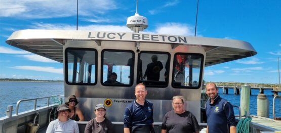
Pakana Rangers and scientists from University of Tasmania and Deakin University have completed mapping and intertidal fieldwork along the western side of the Furneaux/Tayaritja Islands in north-eastern Tasmania.
Seagrass beds around the Furneaux/Tayaritja Islands are some of the most extensive in south-eastern Australia. Previous surveys in the 1990s indicate the seagrasses grow to depths of more than 40 metres. This hub project is using a benthic observation survey system (BOSS) and intertidal sampling to see what seagrass and algal species grow around the islands. The improved understanding of these critical ecosystems will help guide their long-term protection.
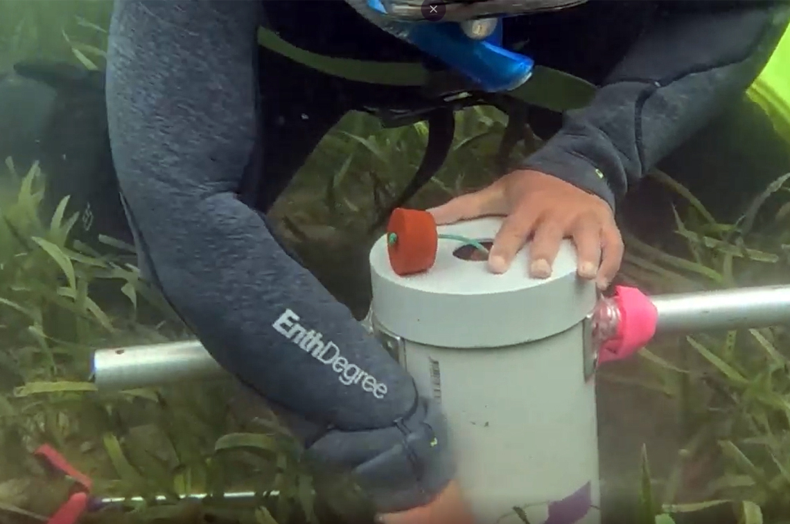
Sampling with the BOSS
The BOSS is lowered from a vessel to the seafloor where eight cameras photograph the habitats from four points of the compass. It was deployed in accordance with a new hub best-practice field manual developed for this sampling platform. This ensures a consistent sampling approach and comparable data.
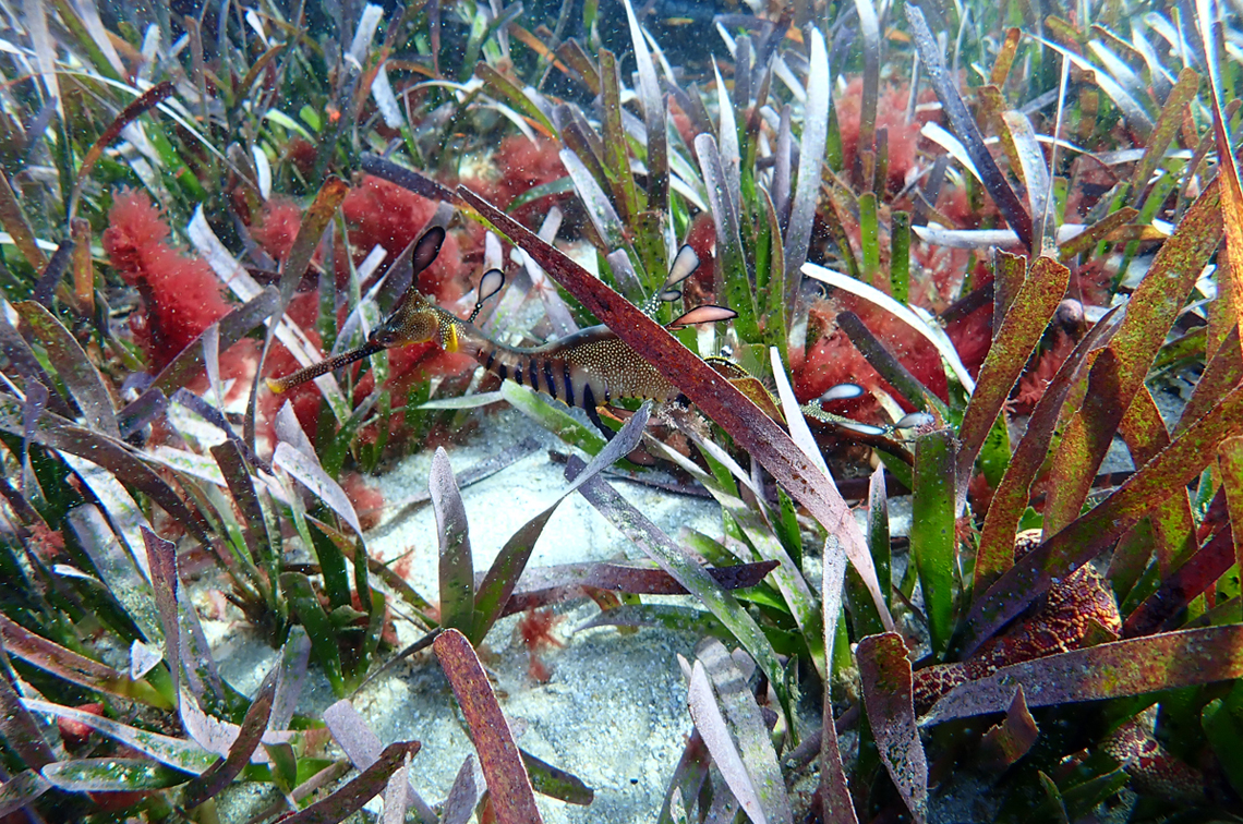
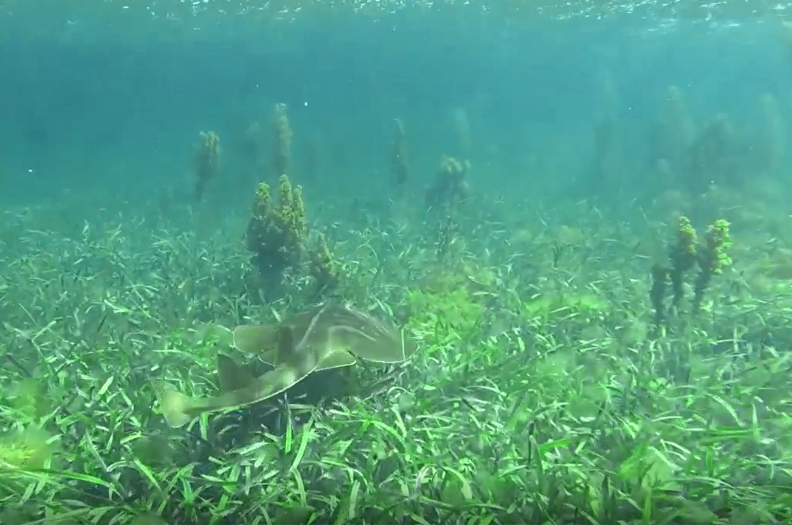
A total of 380 BOSS ‘drops’ have been completed, covering 156,851 hectares of seafloor. This involved 11 busy days in the field, averaging 36 drops a day. The detailed imagery collected by the BOSS is being used to validate and improve the capability of satellite remote sensing data to predict the presence of seafloor habitats. The images are publicly available on SQUIDLE+. They reveal dense and colourful seagrass beds, kelps, and sponge gardens in deeper waters further from the island shores.
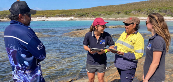
Intertidal treasures
In the intertidal zone, information was collected on epiphytes such as algae and coralline species that grow on seagrass. This is to learn about how epiphytes affect seagrass health and the other animals that live on the seagrasses.
Seagrass leaves from three different species were collected at five field sites for laboratory analysis. Genetic samples were taken from 10 sites to explore genetic links between the seagrass beds. Sediment cores were also taken to measure how much carbon is stored in the seabed. Carbon accumulates in seagrass meadows over time and these ecosystems can store up to twice as much carbon per hectare as forests on land. The project team is keen to discover how much carbon is stored in the seagrass beds.
Towards a monitoring program
The Pakana Rangers and scientists are working to establish a Pakana Ranger-led seagrass monitoring program, recognising the cultural significance of seagrass beds. Rangers are learning how to use a standard drop camera to photograph the seafloor and intertidal sampling methods to monitor seafloor habitats throughout the proposed Tayaritja Milaythina Muka Indigenous Protected Area.
The gallery below offers first glimpses of the underwater habitats around the Furneaux/Tayaritja Islands, through images collected in this collaborative project with the Tasmanian Aboriginal Centre. If these whet your appetite, hop aboard this curated tour on Seamap Australia to explore all the sampling sites.
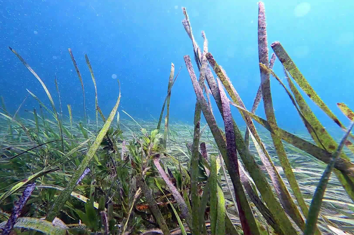 Image: NESP/IMAS/TAC
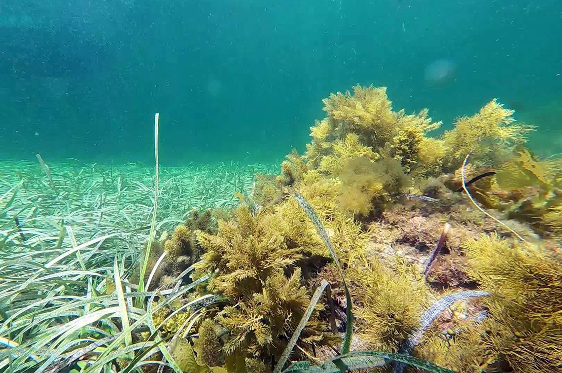 Image: NESP/IMAS/TAC
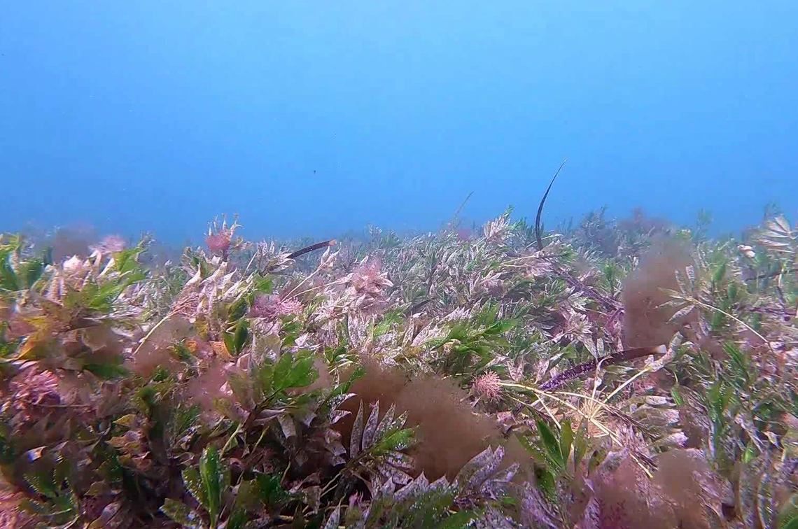 Image: NESP/IMAS/TAC
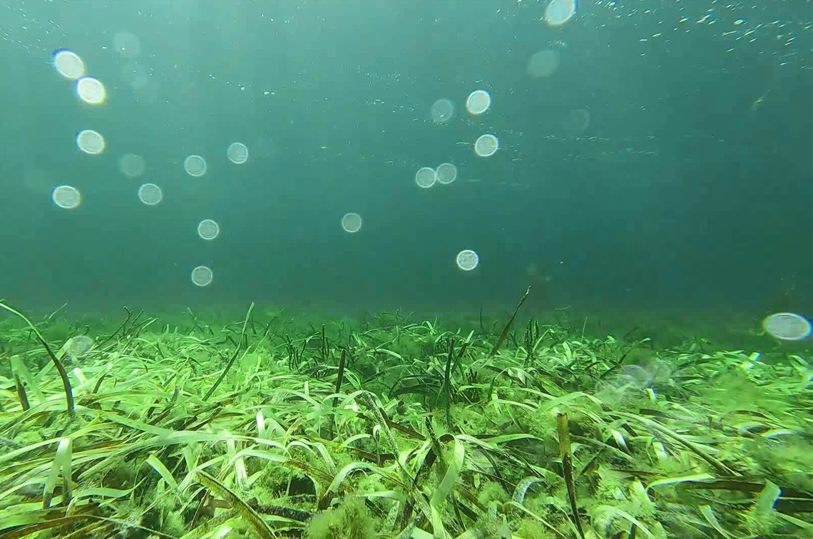 Image: NESP/IMAS/TAC
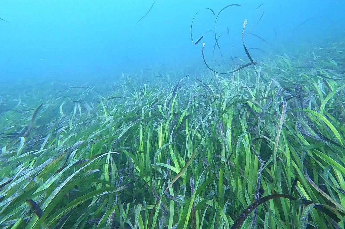 Image: NESP/IMAS/TAC
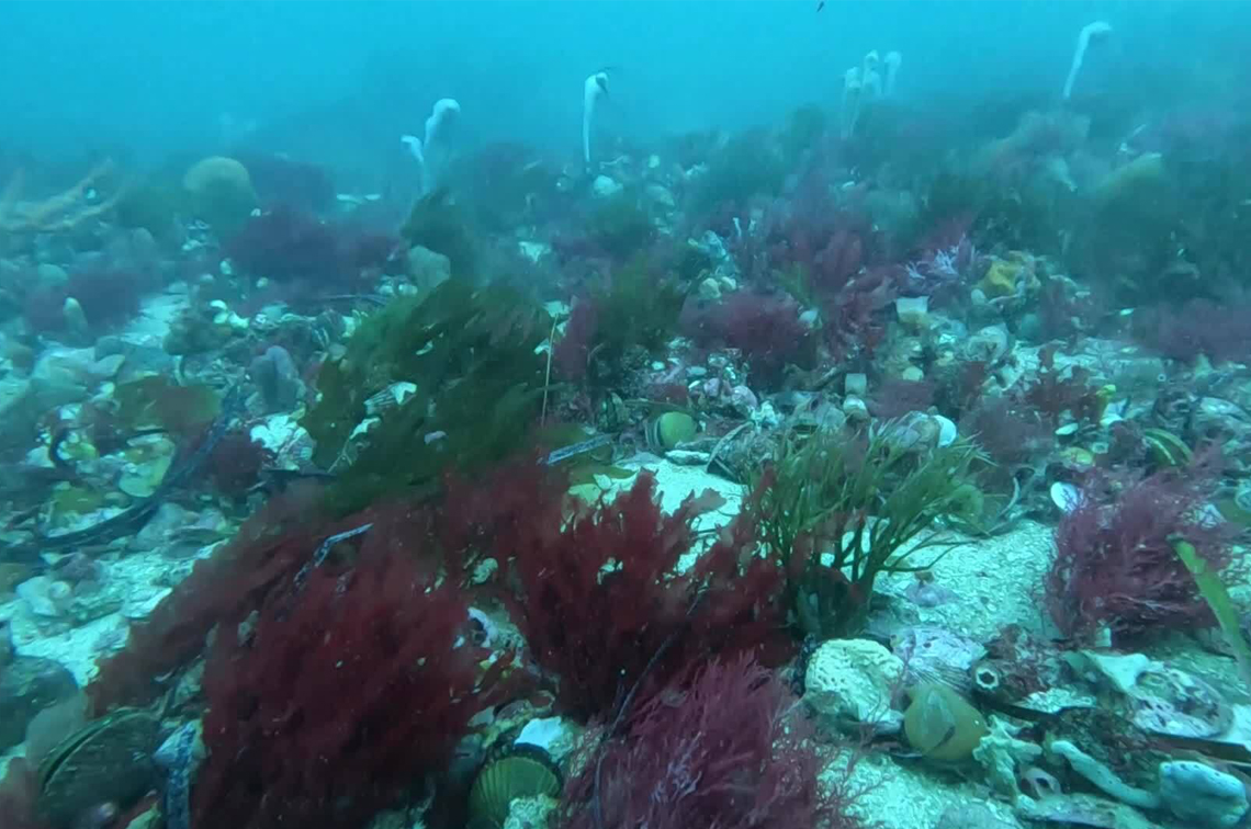 Image: NESP/IMAS/TAC
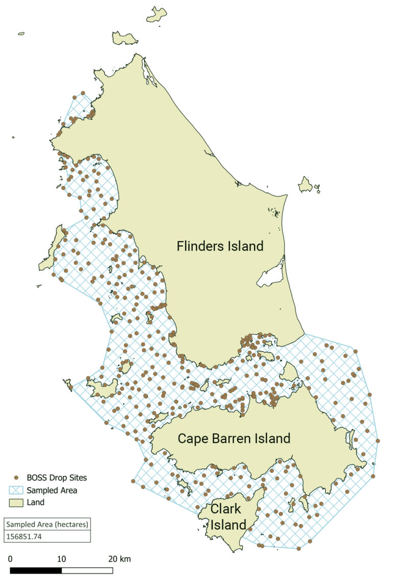
Related information
- Benthic Observation Survey System (BOSS) to survey marine benthic habitats: best-practice field manual on GitHub.
- SQUIDLE+ a tool for managing, exploring and annotating imagery