Article
16 March 2026
A Hub project has compiled, validated and synthesised more than 100 years of seagrass data from Western Australia and the Northern Territory, spanning 1879 to 2023. The result is one of the most comprehensive seagrass spatial datasets ever assembled for northern Australia.
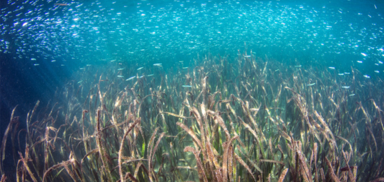
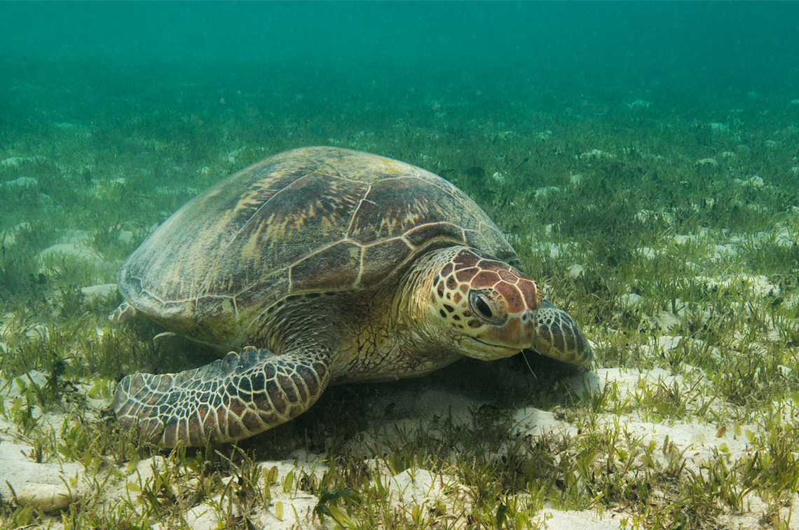
Along northern Australia’s vast coastline, seagrass meadows support dugongs and turtles, shelter fish, store carbon and protect shorelines. They are also central to the culture and livelihoods of First Nations communities.
Yet, despite decades of research, much of the historical information on seagrass has remained scattered. Data were often stored in separate reports, unpublished files or local databases. This made it hard for planners, managers and communities to see the full picture.
The Hub project, led by a research team from James Cook University, Charles Darwin University and Edith Cowan University, aimed to change this.
“Accurate, accessible seagrass data is essential for good management decisions. By bringing together more than a century of information, we can better understand where seagrass occurs, how it has changed and where future effort should focus.”
Dr Caitlin Smith, researcher at James Cook University
The dataset includes more than 147,000 geolocated records and over 500 mapped seagrass polygons. It covers 15 seagrass species, along with information on depth, substrate type and collection dates. The mapped area stretches from Shark Bay in Western Australia to the Northern Territory and Queensland border.
This work builds on earlier syntheses in the Gulf of Carpentaria, Torres Strait and the Great Barrier Reef. Together, these efforts are creating a consistent and accessible baseline for northern Australia. The dataset can help identify biologically important areas, highlight gaps where new surveys are needed and support predictive modelling and marine planning. It also provides a strong foundation for ranger-led monitoring across Sea Country.
A major milestone has been the completion of GIS mapping, with all maps shared directly with Traditional Owners from Karajarri in Western Australia, the Tiwi Islands, South East Arnhem Land and Kurtijar Sea Country.
Importantly, this project has also created strong flow-on benefits.
In South East Arnhem Land, the 2023 survey area has supported the establishment of subtidal seagrass monitoring led by Numbulwar Numburindi and Yugul Mangi Rangers. Funded through an NT Aboriginal Ranger Grant, monitoring was completed in 2024 and 2025, with funding secured to continue in 2026. Drone methods developed under this project helped train rangers and establish local monitoring.
In the Tiwi Islands, survey results have supported co-designed intertidal drone monitoring led by Tiwi Rangers. Monitoring was completed in 2025 and will continue in 2026.
In the southern Gulf of Carpentaria, mapping has guided new intertidal surveys and drone-based monitoring with Normanton Rangers. Similar work is underway with Girringun Rangers in north Queensland.
“This project is about more than producing maps and publishing research articles. It is about building partnerships, co-design, knowledge sharing and strengthening long-term capacity for Indigenous-led monitoring.”
Dr Rachel Groom, researcher at Charles Darwin University
By bringing together more than a century of information and supporting ranger-led monitoring, this Hub project is laying the foundation for better planning and stronger Sea Country management across northern Australia.