Understanding how cyclones affect coastal habitats is crucial as these extreme weather events may become more frequent in the future. Cyclones can cause significant and lasting changes to coastal habitats which are vital for habitats for marine life and provide important ecosystem services to coastal communities. Both people and animals depend on healthy mangroves, seagrass meadows and coral reefs for food and shelter.
In December 2023, Tropical Cyclone Jasper made landfall north of Port Douglas, Queensland. It became the wettest tropical cyclone in Australian history, breaking rainfall records and triggering severe flooding in the region. Despite the scale of the event, no comprehensive on-ground assessment has been conducted to measure the impact of the cyclone and subsequent flooding on coastal habitats like seagrass beds, mangroves, and inshore reefs.
This project aims to evaluate the effects of Tropical Cyclone Jasper and its flooding on inshore coastal habitats in the northern Great Barrier Reef. By understanding changes in these coastal habitats and documenting recovery, this study will explore potential long-term impacts on key species, including dugongs and turtles, and identify opportunities for restoration, rehabilitation, and strategies to accelerate recovery and prevent further habitat loss.
Approach
This project will:
- Conduct comprehensive on-ground assessments using methods such as low-level aerial surveys, boat surveys with underwater camera systems, analysis of satellite and drone imagery, and synthesis of other available information to compare current conditions with recent historical data and determine any impacts of TC Jasper.
- Update coastal habitat data for the region, addressing gaps in some areas where data is over 30 years old (e.g., seagrass data last collected in the 1980s for certain locations).
- Build capacity among Traditional Owner groups through on-ground activities, providing training and skills to support monitoring of their Sea Country.
Expected outcomes
- A map of coastal habitats offering up-to-date information on the condition of coastal intertidal and subtidal habitats in the northern Great Barrier Reef, enabling well-informed management decisions and actions.
- Validated on-ground data to support and enhance climate change models, habitat suitability and predictability models, and remote sensing work focused on coastal habitats in the region.
- A detailed description of the impacts of an extreme weather event on coastal habitats in the northern Great Barrier Reef and an understanding of short-term recovery, as well as recommendations for restoration, rehabilitation, accelerated recovery, and strategies to reduce further habitat loss, aligning with the State Disaster Recovery Program.
- Improved understanding of the downstream impacts of Tropical Cyclone Jasper on threatened and migratory species, such as dugongs and turtles.

Assistance provided through the jointly-funded Commonwealth-State Disaster Recovery Funding Arrangements (DRFA).
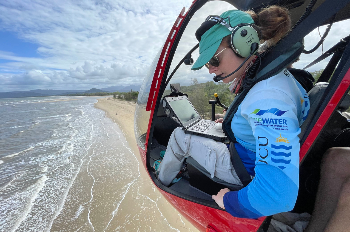 TropWATER researcher Abbi Scott in helicopter carrying out aerial survey. Image: TropWATER.
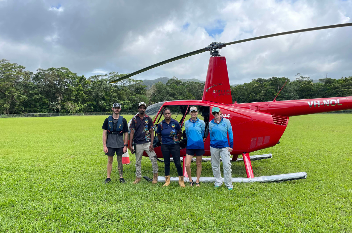 Jabalbina Rangers and TropWATER researchers with survey helicopter. Image: TropWATER.
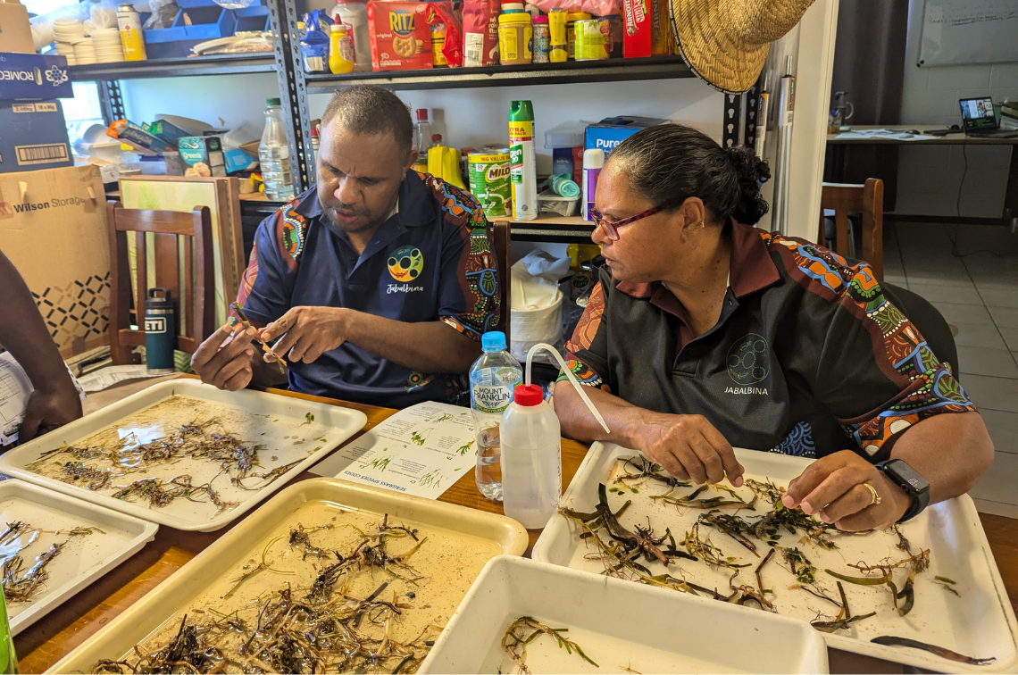 Jabalbina Rangers identifying seagrass samples. Image: TropWATER.
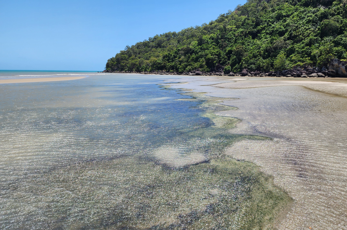 Seagrass meadow in Yarrabah. Image: TropWATER.
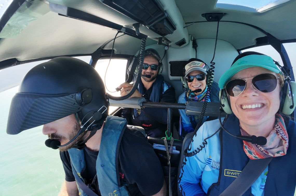 Researchers and Yirrganydji Ranger carrying out helicopter survey. Image: TropWATER.
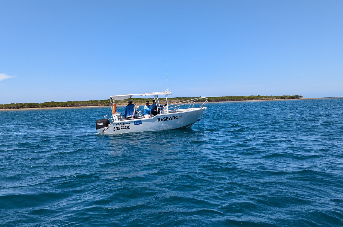 TropWATER Researchers and Jabalbina Ranger carrying out camera surveys from a boat. Image: TropWATER.
Project location
Project leaders
Research partners
James Cook University
TropWATER
Collaborators
Department of the Environment, Tourism, Science and Innovation
Research users
Traditional Owners
Great Barrier Reef Marine Park Authority
Queensland Government
Great Barrier Reef Foundation
Northern Australia Indigenous Land and Sea Management Alliance
Coastal councils
Land and sea rangers
Department of Climate Change, Energy, the Environment and Water
Other – Project 5.1 – Project 5.2 – Project 5.4 – Project 5.5 – Project 5.6 – Project 5.7 – Project 5.9 – Project 5.10
Marine and Coastal Hub Research Showcase 2025 presentations
Marine and Coastal Hub Research Showcase 2025 presentations. National Environmental Science Program.
Fact sheet – Project 5.5
Project 5.5 Information sheet
NESP Marine and Coastal Hub (2025). Assessing impacts of extreme events on inshore coastal habitats in the northern Great Barrier Reef. Project 5.5 Information sheet. Reef and Rainforest Research Centre, Cairns, Queensland.