Media release
31 July 2024
Scientists are heading out with underwater robots to re-survey the coarse sands, sponge-covered reefs, and mysterious gatherings of sharks at Beagle Marine Park in Bass Strait.
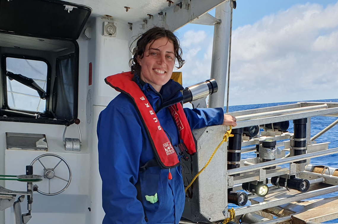
The two-week voyage on the marine research vessel (MRV) Ngerin is led by the University of Tasmania’s Institute of Marine and Antarctic Studies (IMAS) and funded by the Australian Government through the National Environmental Science Program.
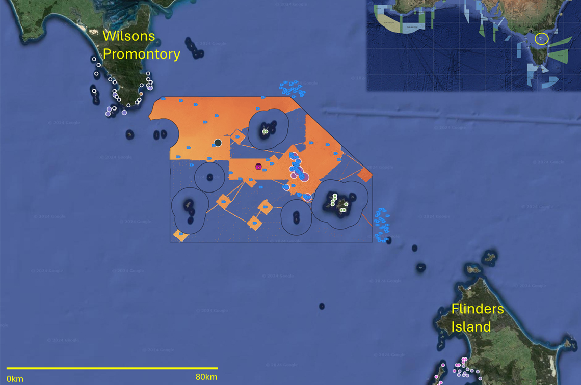
Beagle Marine Park covers almost 3000 km2 of central Bass Strait waters. It is one of 60 Australian Marine Parks managed by Parks Australia, and it surrounds the state-managed Kent Group Marine Reserve (Erith, Dover, North East, and Deal islands), and the Hogan, Southwest and Curtis Island groups.
“These islands were once hills on the Bassian Plain, a landscape of dunes and grasslands immersed about 10,000 years ago by rising seas,” voyage leader Jacquomo Monk of IMAS says
“The lithified dunes now form reefs 50–70 m below the surface, covered with sponges and other invertebrates well fed by the tidal currents.”
Dr Monk says that when he and his colleagues first surveyed the park in 2018, they only had very fuzzy maps of the seafloor to go by.
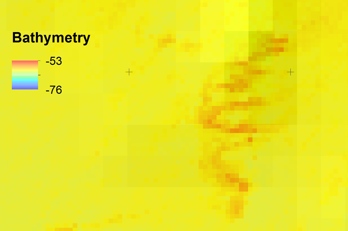
“Detailed mapping by the hub and the Australian Hydrographic Office has since provided an initial understanding of about 60% of the park’s seabed structure,” he says.
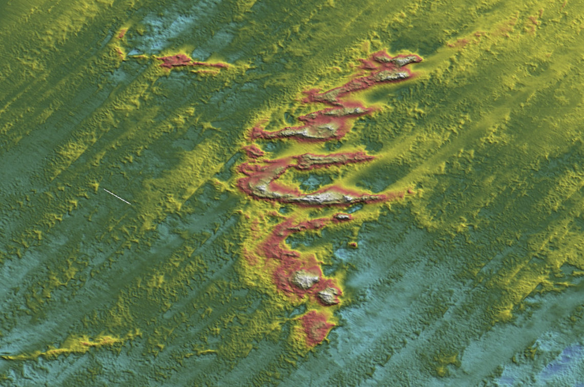
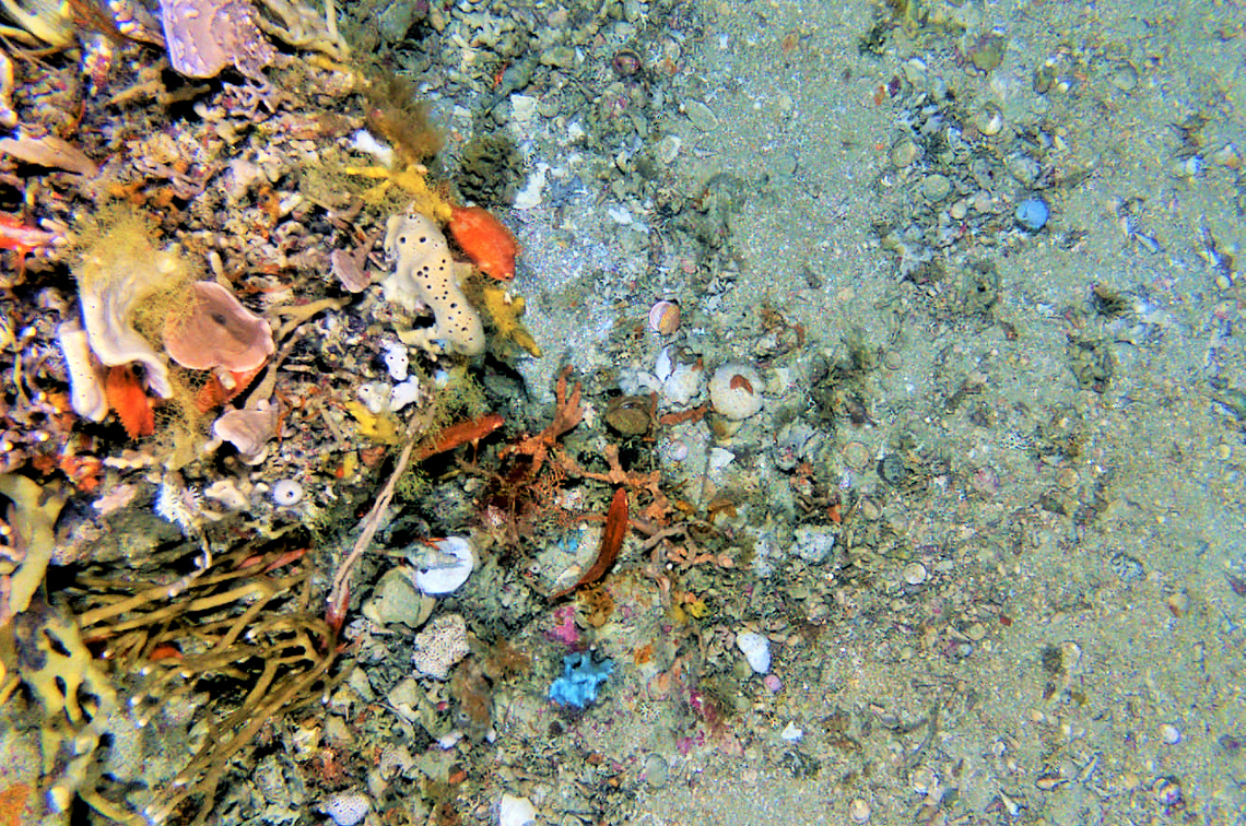
“Back in 2018 we took tens of thousands of images using an autonomous underwater robot and 100s of baited video cameras to create an inventory of life in different depths and habitats.
“These datasets are on the interactive portal Seamap Australia, which brings together imagery hosted on the SQUIDLE+ platform, funded through the Integrated Marine Observing System. This platform allows management, discovery and annotation of marine imagery.
“Combining this imagery dataset with mapping layers in Seamap Australia gives marine park managers a desktop view of the action, minus the gusting winds and choppy seas.
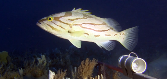
“They virtually dive into the park and see mesophotic (mid-light) rocky reefs covered in diverse and colourful sponges, vast carpets of doughboy scallops, and short videos of more than 60 species of sharks and other fishes.
“On this voyage we will go back to the same sampling sites to see what may have changed.”
Dr Monk says he is interested to see how seafloor ecosystems are recovering a further seven years after the removal of trawl fishing and scallop dredging in the area more than 15 years ago.
“We are aiming to start quantifying the changes in the composition and size of fishes and the invertebrate life growing on the seabed over time,” he says.
“We’ve found that in other marine parks in the south-east, such as Tasman Fracture south of Tasmania, the abundance and size structure of fishes and sponges have changed since their protection 15 years ago. It will be interesting to see if these patterns are also present in the Beagle.”
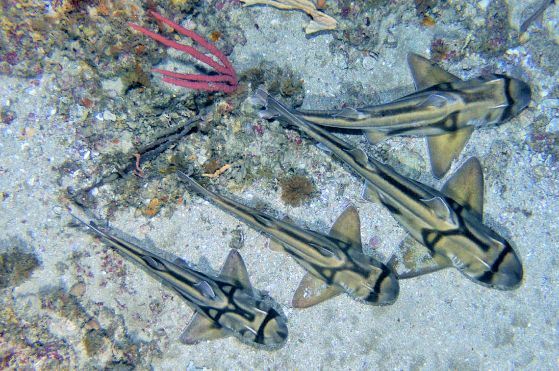
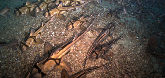
The scientists are also keen to see their old friends the Port Jackson sharks.
“Last time we came upon a shark slumber party,” Dr Monk says. “There were thousands of them lounging among the reefs. It’s such a cool aggregation and it raises interesting questions.
“Was it a one-off, or an annual gathering? Do they come to feed up on scallops before heading off to their breeding ground? It could be Beagle’s very own longitudinal study.”
Port Jackson sharks (also known as ‘Sleepy Joes’) often gather in places such as ledges and appear to sleep, but are rarely seen in such large numbers.
“They typically lay their eggs in coastal waters of Victoria and mid-to-southern NSW from in late winter, so perhaps it may be a mating aggregation or simply a ‘buffet’ for the sharks to fatten up before their long trip up the coast,” Dr Monk says.
The upcoming survey has real world implications. It will develop and trial protocols for standardised reporting on the condition of the organisms that call the Beagle home, and whether this is changing.
“This standardisation will help marine park managers compare between management zones and across parks,” Dr Monk says.
“As with all adaptive management, park managers need good quality data to allow them to accurately assess how well the parks are meeting conservation goals.”
Another important purpose of the repeat survey is to provide new data that can be used to compare with nearby areas outside the park that are subject to development.
“We have extensive areas adjacent to the park being considered for offshore wind farms, the surveys at Beagle may provide a useful reference data for this emerging industry,” Dr Monk says.
More about Ngerin and SQUIDLE+
MRV Ngerin is part of the Southern Coastal Research Vessel Fleet. The SCRVF is a partnership between the South Australian Research and Development Program and the Department of Primary Industries and Regional Development, with funding from the National Collaborative Research Infrastructure Strategy (NCRIS) and support from the CSIRO Marine National Facility, to provide the marine research community with better access to coastal research vessels in Southern Australia.
SQUIDLE+ is an open software platform for the management, discovery and annotation of marine imagery developed as part of Australia’s Integrated Marine Observing System’s Understanding of Marine Imagery Facility. IMOS is enabled by NCRIS. Dive in to explore more images.
Media contact
Bryony Bennett:

