The north-west Kimberley coast supports six of the world’s seven marine turtle species. Green (Chelonia mydas) and flatback turtles (Natator depressus) are both listed as Vulnerable under the EPBC Act 1999, and nest widely in this region. These turtle species are culturally significant to Traditional Owners across the region, known as Juluwarru (green) and Mardumal (flatback) in local language.
Flatback turtles are endemic, only found nesting in northern regions of Australia. Despite their ecological and cultural significance, there remain important gaps in current knowledge on where turtles nest, habitat use, nesting densities, seasonal nesting differences between species and how climate change may affect turtle nests. This project, led by the Wunambal Gaambera Aboriginal Corporation (WGAC), directly addresses these gaps by analysing an extensive dataset of aerial imagery of the Uunguu Indigenous Protected Area (IPA), which encompasses over 15,000 km² of Sea Country.
Without accurate spatial data on key nesting sites, habitat use and threats, it is difficult to plan protection, identify climate refuges or guide management across this remote coastline. There is also a need to ensure Traditional Owner knowledge and priorities drive conservation planning on Sea Country.
Approach
- Map nesting habitat for green and flatback turtles across the Uunguu Indigenous Protected Area, in the north-west Kimberley, using high-resolution aerial imagery. This imagery was collected from aerial surveys conducted December 2023 and August 2024 to capture nesting information on the wet and dry seasons respectively. This imagery is detailed enough to identify turtle species from track shape, estimate nesting success, describe beach features and record signs of predators.
- Analyse these images to locate primary nesting beaches, measure nesting density and describe habitat characteristics such as beach length and orientation.
- Assess climate risk to the identified nesting locations using modelling to reconstruct and project sand temperatures at nest depth. These projections will be used to project the effect of rising sand temperatures on nest success (e.g., hatchling success and sex ratios) under future climate warming.
- Organise a Traditional Owner-led workshop to corroborate survey results, highlight priority areas for conservation zoning within the protected areas and identify potential Biologically Important Areas (BIAs) based on culturally significant areas for sea turtles within the IPA and the results of the survey.
Expected outcomes
Mapped nesting distributions and nesting densities for green and flatback turtles across the Uunguu Indigenous Protected Area. These spatial products will identify high-density nesting beaches and other important habitats for management.
Traditional Owner-led identification of high-priority nesting sites for conservation zoning and for recognition as Biologically Important Areas. This supports Wunambal Gaambera Aboriginal Corporation’s Healthy Country Plan.
Assessment of climate vulnerability for key nesting beaches using projections of sand temperature and expected impacts on turtle nests.
Technical reports and spatial datasets delivered to research users, including Indigenous ranger groups, government agencies and conservation planners. These products will inform spatial planning, regulatory processes and on-ground management of threatened marine turtles in the Western Kimberley.
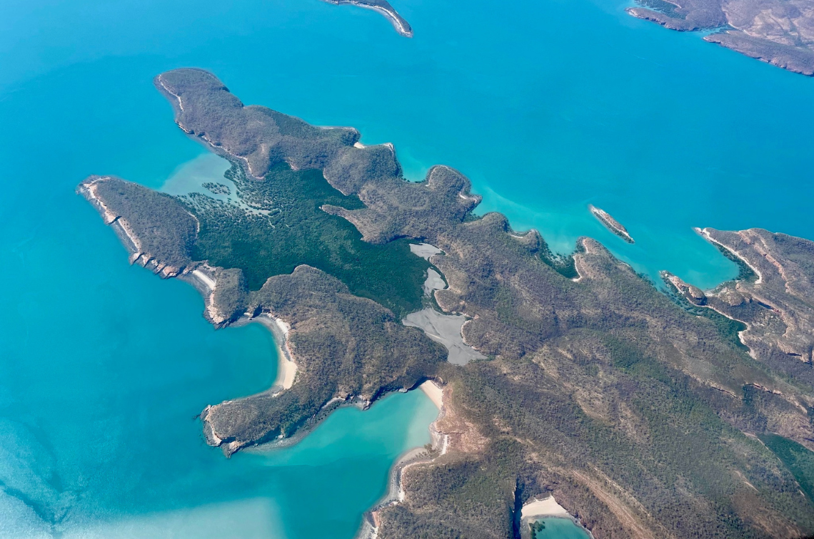 Kimberley coastline. Image: Jill Rischbieth / Bush Heritage Australia
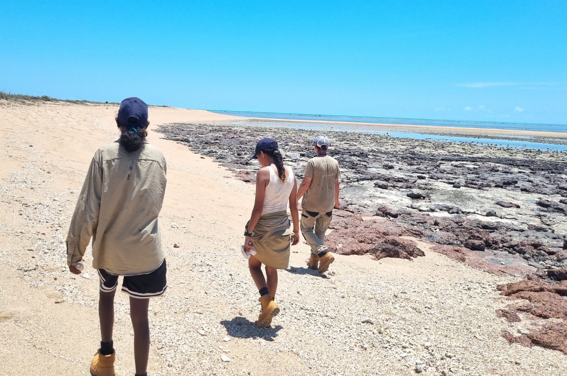 Uunguu Rangers and Project Leader Tom Vigilante. Image: Jill Rischbieth / Bush Heritage Australia
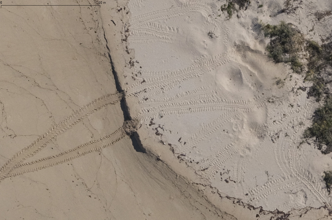 North Maret flatback nest in winter. Image: WGAC / DCCEEW
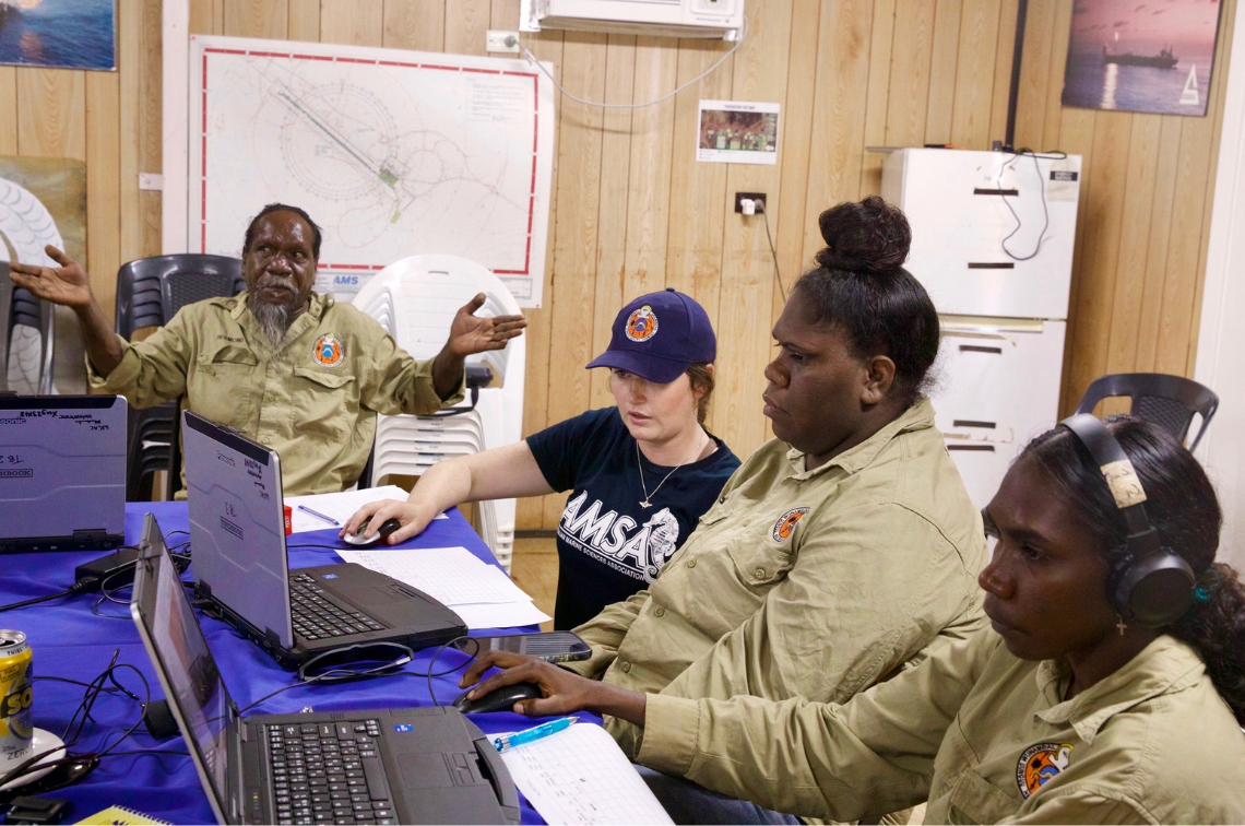 Uunguu Rangers and Project Leader Melissa Staines attending a GIS workshop. Image: Jill Rischbieth / Bush Heritage Australia
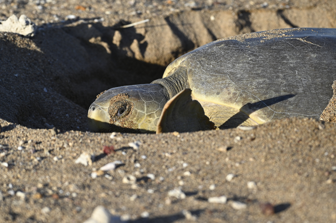 Nesting flatback sea turtle on Troughton Island. Image: Cass Wilson and Matt Frogley
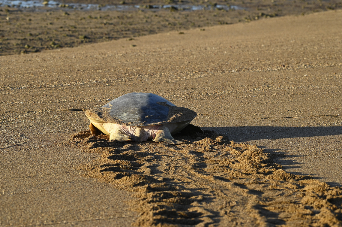 Nesting flatback sea turtle on Troughton Island. Image: Cass Wilson and Matt Frogley
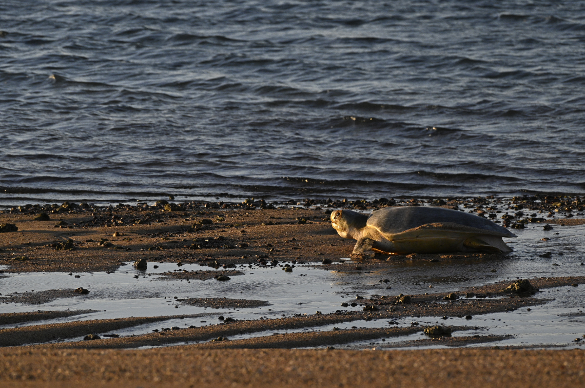 Nesting flatback sea turtle on Troughton Island. Image: Cass Wilson and Matt Frogley
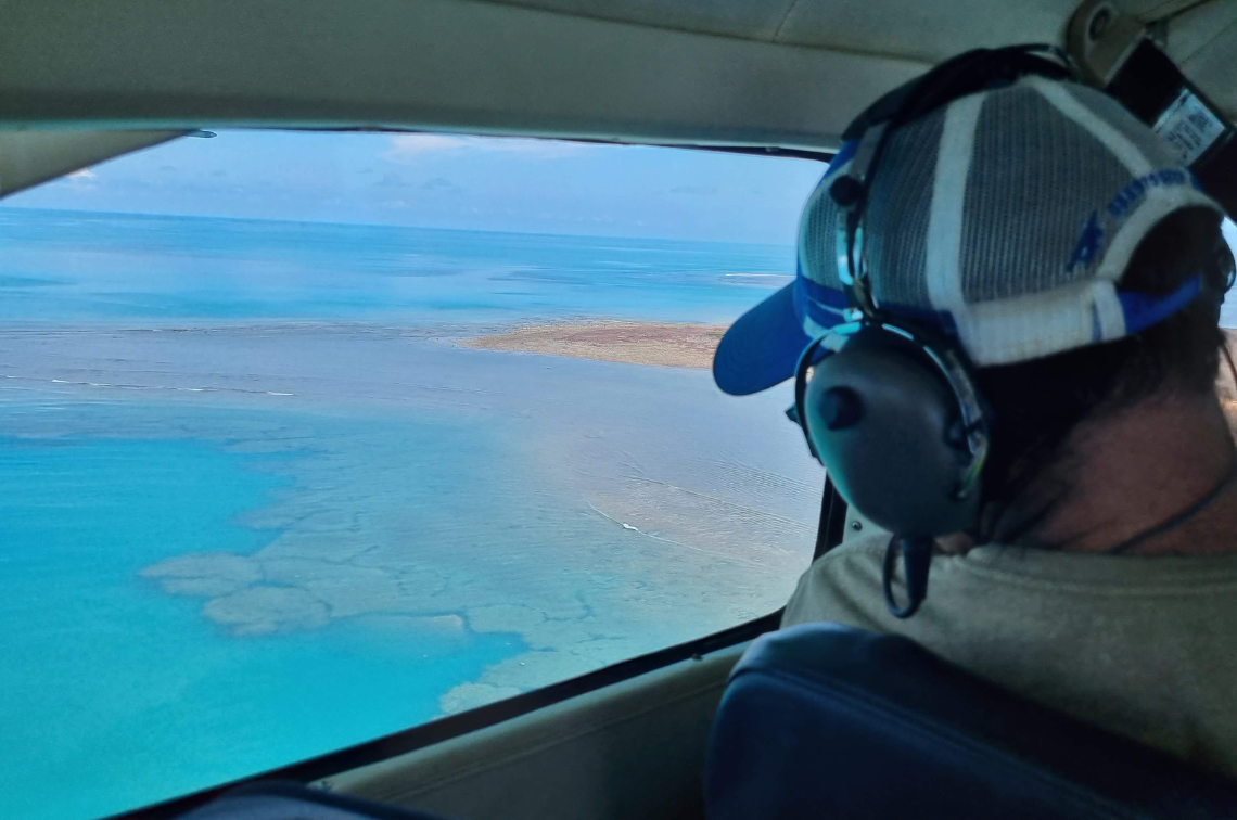 Project Leader, Tom Vigilante, in transit to Troughton Island. Image: WGAC
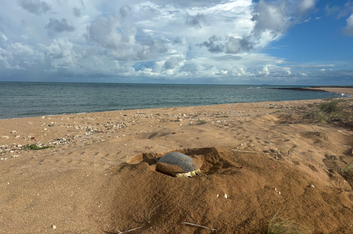 Nesting flatback sea turtle on Troughton Island. Image: Cass Wilson and Matt Frogley
Project leaders
Tom Vigilante
Bush Heritage Australia
Wunambal Gaamberra Aboriginal Corporation
Collaborators
Wunambal Gaambera Aboriginal Corporation
Research users
Indigenous communities
Wunambal Gaamberra Aboriginal Corporation
Land and sea rangers
Traditional Owners