Article
4 June 2026
Wadandi/Pibulmun Yunungjarli Senior Cultural Custodian, Zac Webb, tells a spine-tingling tale of collaborative research mapped on ancient knowledge.
For the past five years, the Marine and Coastal Hub has been walking alongside the Wadandi people of south-western Australia. The Wadandi are Traditional Owners of the Country stretching from Capel below Bunbury, inland to Nannup, and south to Taalinup (Augusta). As Saltwater People, they draw their name from Wadan, the ocean spirit.
Our collaboration began through cultural mapping, providing a blue-print that encoded ancient knowledge that informed our biodiversity surveys, elevating them from data collection to a broader landscape understanding. The Cultural Custodians reminded us that the ‘old songlines are out in the ocean’. Much of what they wished to share lay beneath the waves, and out of sight.
To see what the knowledge holders were seeing, we first deployed baited remote underwater stereo-video systems (stereo BRUVs), capturing glimpses of the seafloor at depths of 55–70 metres. But the powerful Leeuwin Current repeatedly swept the stereo BRUVs away.
Fortunately, our work coincided with the development of the Benthic Observation Survey System (BOSS), a remote, wide-field camera system designed by hub partners for habitat mapping. The BOSS could withstand depths well beyond 200 metres, offering a far more stable window into the submerged cultural landscape. Paired with recently collected multibeam sonar mapping, these technologies allowed the hub team to build a picture of the seabed that could sit alongside Cultural Custodians’ cultural maps.
When we laid these knowledge systems together, something remarkable began to emerge. We saw features on the seafloor that aligned with ancient stories of the ‘cold times’ and ‘fresh water places’ when camps once stood on land that is now far offshore. Guided by knowledge holders, we narrowed our focus to a songline from Taalinup (Augusta) tracing the route of the Blackwood River.
To the Wadandi, the Blackwood is Goorbiliyup. Its name comes from Goorbil (small intestines), describing the river’s winding path, and Bilya (river), with -up meaning ‘place of’. Beginning near Lake Bumbleyung in the Great Southern, Goorbiliyup flows from Taalinup, where it marks the meeting place of the Indian and Southern Oceans. Culturally, it also divides two groups: the Wadandi Saltwater People to the north and the Pibulmun – the People of Plenty – to the south.
Revealing Goorbiliyup
As part of an Our Marine Parks Grant with Jacquomo Monk from the Institute of Marine and Antarctic Studies at the University of Tasmania, we deployed a remotely operated vehicle to search for this submerged river. After several dives, we encountered it: a 5–8-metre-high wall – the ancient riverbank – with the riverbed stretching 100 metres across in places. The profile was unmistakable. This was Goorbiliyup, lying along the songline shared by the Cultural Custodians and now revealed by multibeam mapping and underwater imagery.
In that moment, cultural science and contemporary marine science met, putting our shared understanding of the landscape and the marine environment into context.
The stories held and passed down for up to 3000 generations had guided us to a river system that 12,000 years ago would have run down to a Wadandi shore – now 60 m below the sea. It’s a reminder of the immeasurable human history of this region, where modern archaeology has dated camp sites such as Devil’s Lair, to 47,000 years ago.
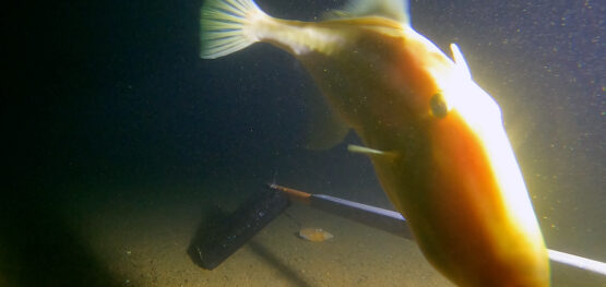
 A foxfish and a blue-lined leatherjacket match the colours of this mesophotic (mid-light) rocky reef at a depth of 65 m. Image: UWA/IMAS/Undalup Association
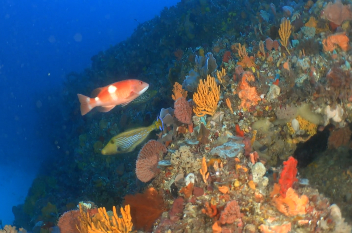
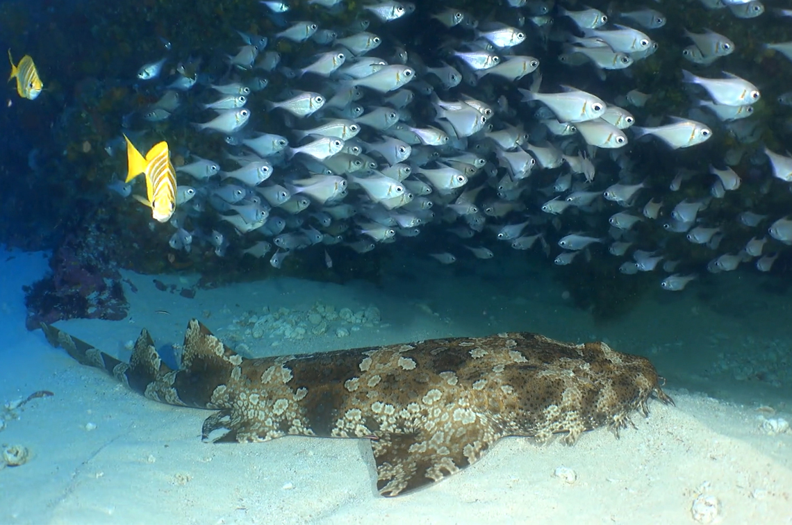 Rough bullseye school above a banded wobbegong at a depth of 61 m. Image: UWA/IMAS/Undalup Association
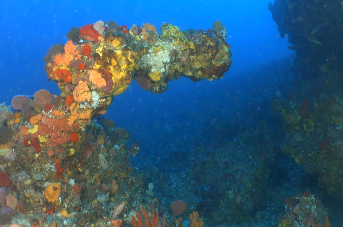 An unusual reef formation. The rocky reefs formed from the ancient riverbank now support invertebrates dominated by a diverse assemblage of vibrant coloured sponges, delicate hydroids and bushy bryozoans. Image: UWA/IMAS/Undalup Association
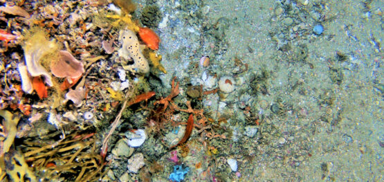
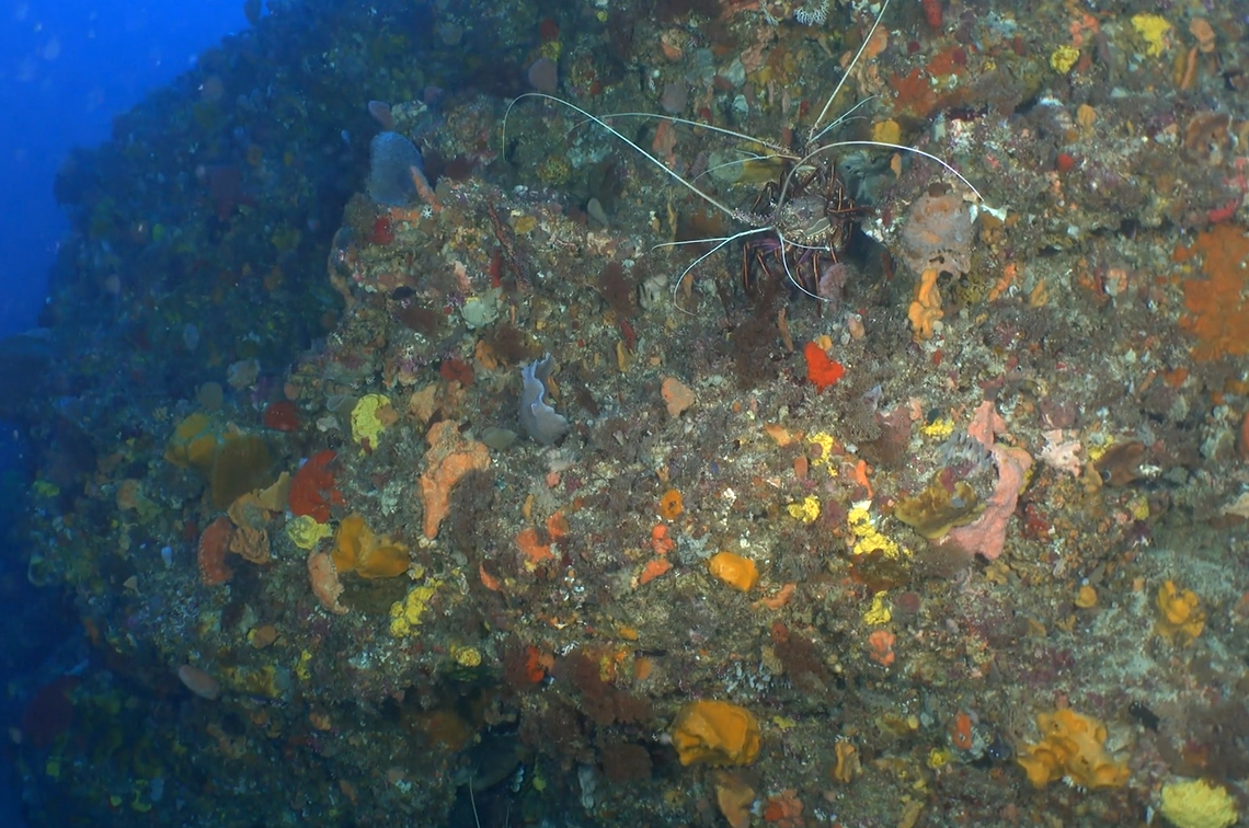 A western rock lobster finds the perfect niche among the sessile invertebrate habitat. Image: UWA/IMAS/Undalup Association
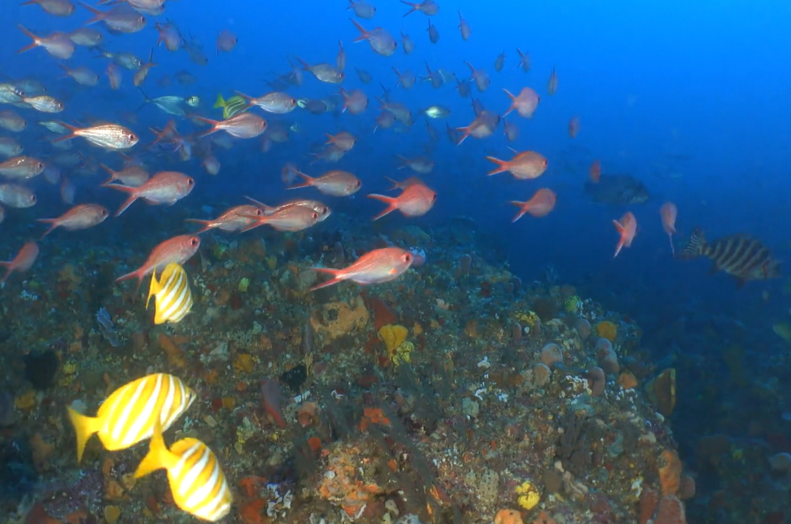 Fish communities (footballer sweep and swallowtail) swim along the ancient riverbank. Image: UWA/IMAS/Undalup Association
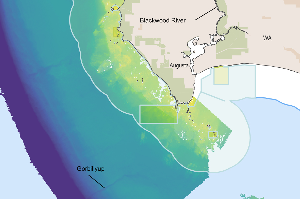 Location of Gorbiliyup in South-west Corner Marine Park off Western Australia. Image: UWA
So far, we have explored only a small portion of this extraordinary riverbed and we now know the location of other cultural features which we suspect will be far more impressive. With continued support – and a little luck from the Leeuwin Current keeping the waters clear – we hope to explore more of it.
For the Wadandi people, this work reaffirms what they have always known: land and sea are one continuous cultural seascape, where rivers carry songlines from inland Country to the deep ocean, forever connecting people to place.
This collaborative research journey has received funding from the Australian Government's Our Marine Parks Grant Program Parks Australia and from the National Environmental Science Program.
Zac Webb presented this story as part of the Marine and Coastal Hub webinar series.
Further information
- The Cultural Seascape of Wadandi Boodja: Marine Biodiversity Hub report
- Guiding surveys on Wadandi Saltwater Country: Undalup Association video
- Fishes and habitats of the South-west Corner Marine Park: UWA Marine Ecology Group video
- Benthic Observation System (BOSS) for surveys of marine benthic habitats: journal article