Article
1 December 2025
From July to September 2025, Indigenous rangers from Queensland, the Northern Territory and Western Australia joined researchers to film a series of seagrass monitoring activities.
The fieldwork took place in the Kimberley, WA, southern Gulf of Carpentaria, NT, central Great Barrier Reef, QLD, and Torres Strait, as part of a hub project that is developing a toolkit for ranger-led seagrass monitoring. It documented how rangers use different techniques to monitor the health of vital seagrass meadows, including drone mapping, underwater camera surveys from boats and intertidal transect walks.
More than 15 rangers took part in the monitoring and filming activities, including Karajarri, Marranbala, Girringun and Mabuyagiw Rangers, with support from Karajarri Traditional Lands Association, Namultja Aboriginal Corporation, Girringun Aboriginal Corporation and the Torres Strait Regional Authority Land and Sea Management Unit, filmmakers Gus Burrows (Styledia) and Sam Frederick, and researchers from James Cook University, Charles Darwin University and Edith Cowan University. The footage captured during these activities will form part of a new suite of accessible training resources to support ranger-led seagrass monitoring across northern Australia.
“The resources will give ranger groups clear, practical steps for monitoring seagrass in different environments. It is designed so each group can select the best methods for their Sea Country while collecting data that contributes to a broader national picture,” said project co-leader Dr Alex Carter of James Cook University’s TropWATER.
“The monitoring was very interesting to the Rangers because we learnt about the different seagrass that we have on our country and that we can use data in the future if we wanted to do mapping or find out about the dugong habitat and feeding grounds. That is also important to us,” Kelvin Mitchelson from the Karajarri Rangers said. “The crew also had to do the run down on setting up and packing the equipment that were used, that was very handy for future if wanted to go out and do it on our own we now have the skills and knowledge.”
Seagrass meadows are among the most productive ecosystems on Earth. They provide food and habitat for threatened species such as dugongs and green turtles, protect coastlines from erosion, and store significant amounts of carbon. Yet these habitats are under growing pressure from climate change, cyclones, flooding and human activity. Many areas across northern Australia remain poorly studied, and consistent monitoring data are limited.
This hub project addresses this gap by co-developing a practical toolkit for rangers to survey, map, and assess seagrass health using a consistent monitoring framework tailored to local conditions. The project’s co-design process ensures the tools, training materials, and monitoring protocols reflect local priorities, Indigenous knowledge and the diversity of northern coastal environments. The project is also building technical capacity within ranger groups through hands-on training and the creation of multimedia resources that demonstrate best-practice survey methods.
“Our goal is to make seagrass monitoring accessible and consistent across the north, giving ranger groups the confidence and tools to independently lead long-term monitoring of seagrass.”
Dr Alex Carter, JCU TropWATER
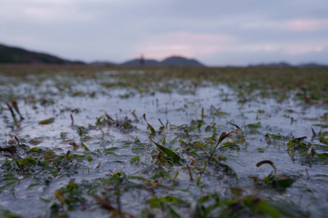 Close-up of Mabuyag Island intertidal seagrass meadow (QLD). Image: Styledia.
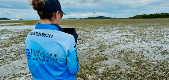
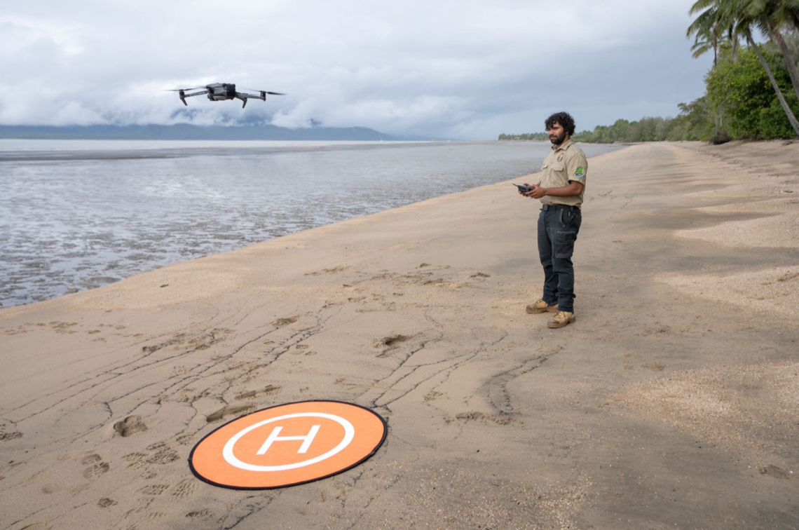 Doug Bulmer, Girringun Ranger, starting to fly a drone for intertidal seagrass surveys to monitor seagrass on Girramay Country in Cardwell, QLD. Image: Styledia.
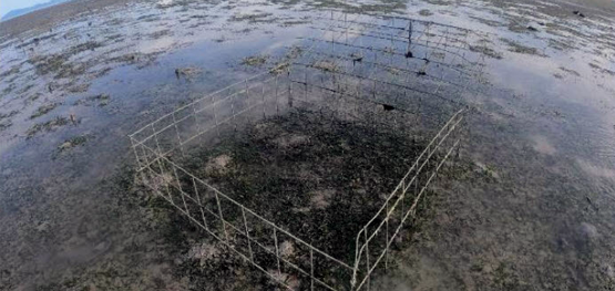
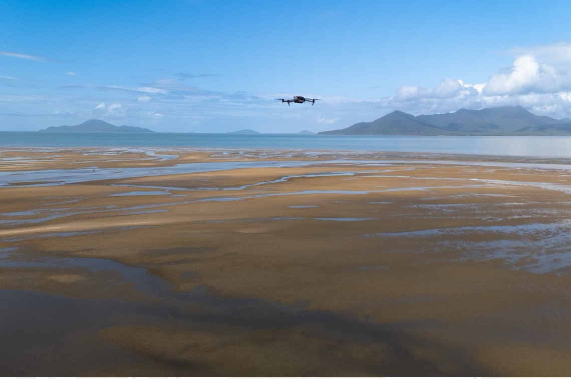 Drone flying above the intertidal seagrass meadow on Girramay Country at Meunga Creek, QLD. Image: Styledia.
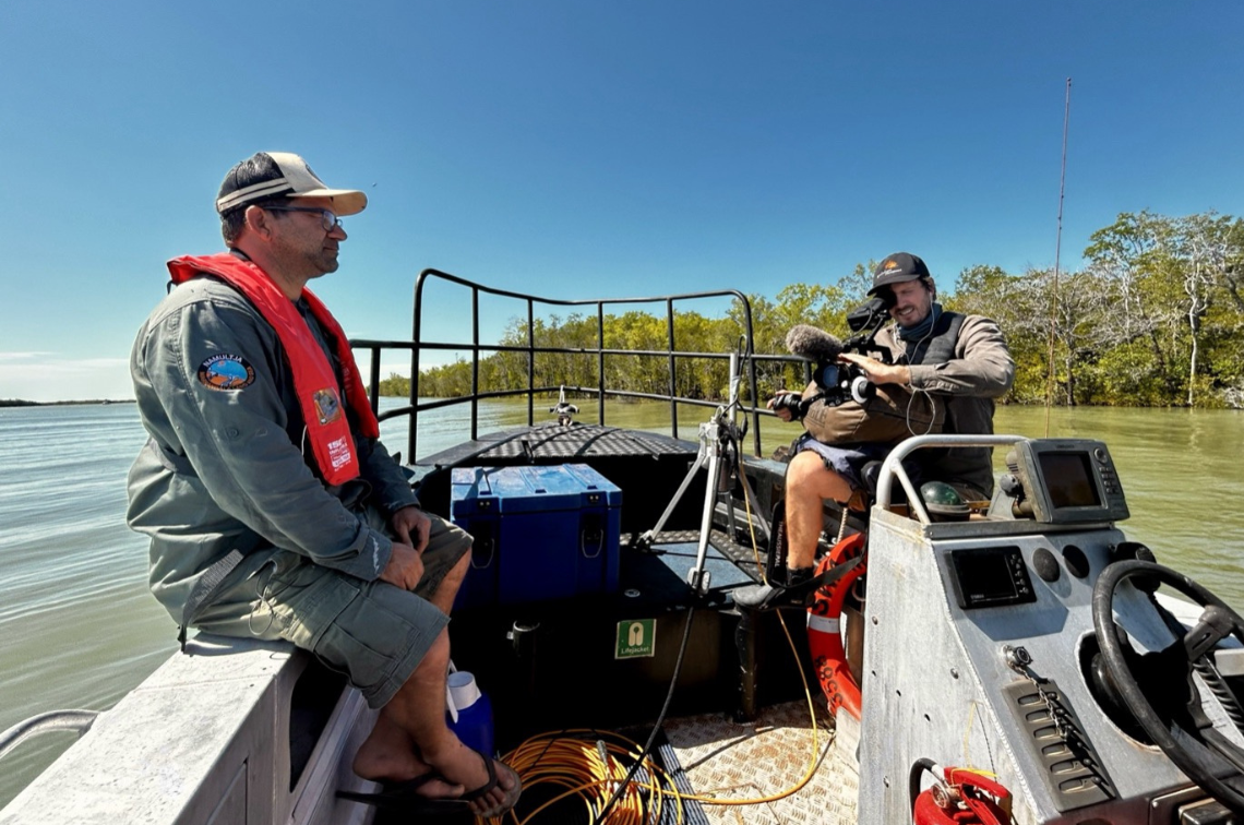 Marranbala Ranger David Barrett being filmed on Marra Sea Country by filmmaker Sam Frederick (Limmen River, NT). Image: Alex Carter, JCU.
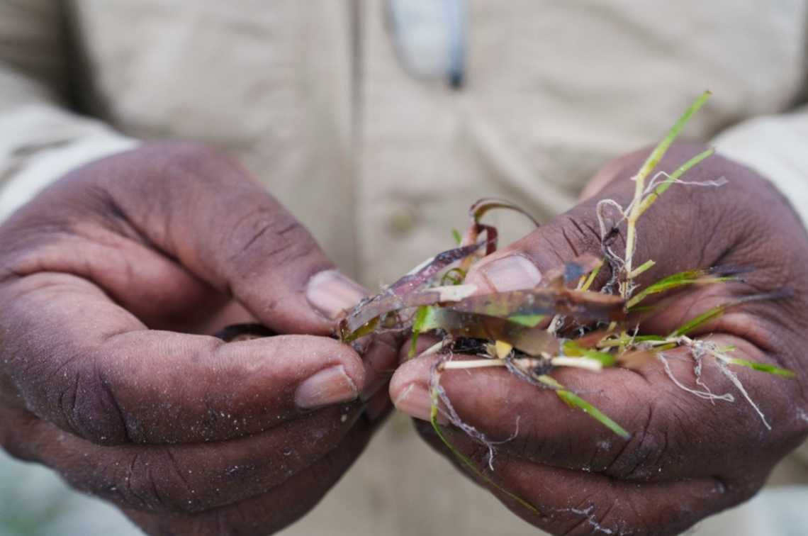 Terrance Whap holding multiple seagrass samples from Mabuyag Island. Image: Styledia.
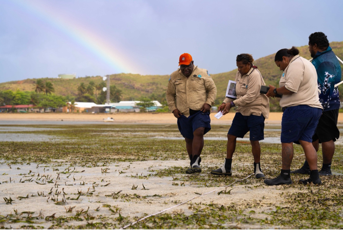
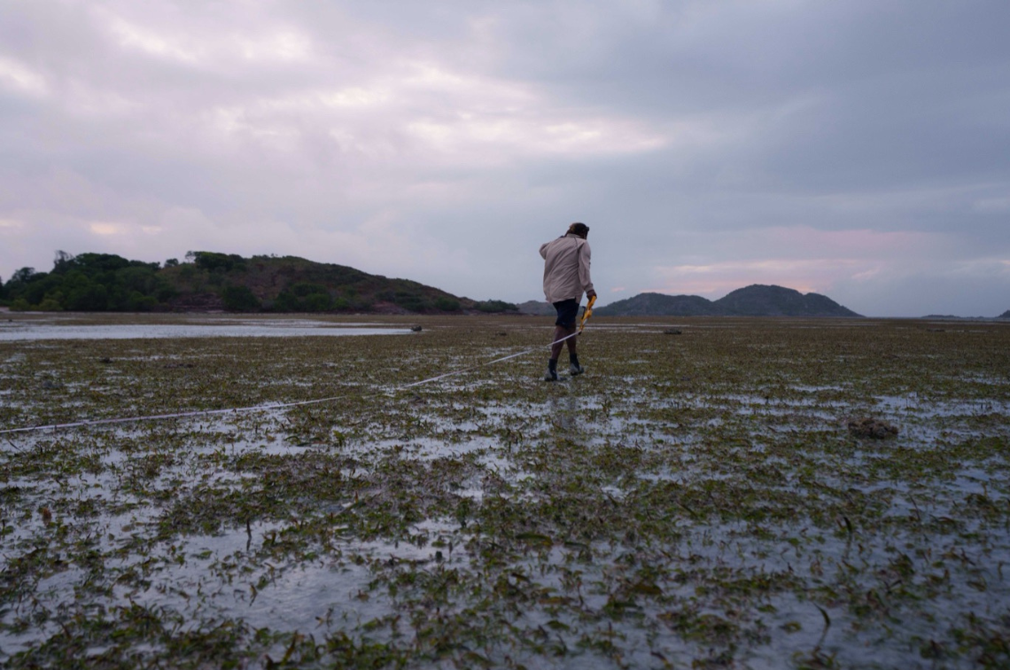 Virginia Harry, Mabuyagiw Ranger, walking out the transect to do surveys (Mabuyag Island, QLD). Image: Styledia.
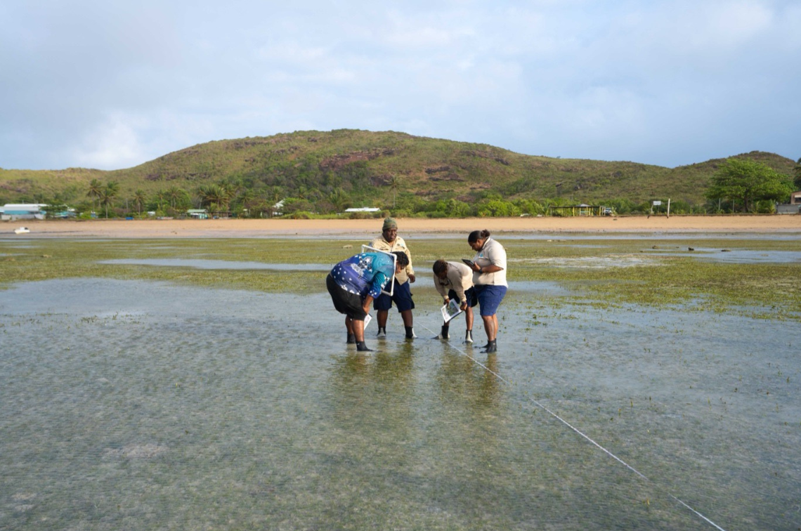 Mabuyagiw Rangers Sam Joe, Terrance Whap, Virginia Harry, and Harriet Holland (left to right) examining seagrass and invertebrate composition along a transect on Mabuyag Island. Image: Styledia.
 Girringun Rangers Shantaishe Congoo (left) and Doug Bulmer (right) preparing for drone take-off to conduct intertidal seagrass surveys on Girramay Country at Meunga Creek, QLD. Image: Styledia.
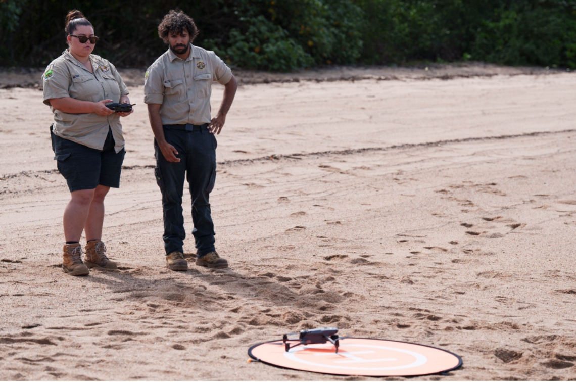 Girringun Rangers Shantaishe Congoo (left) and Doug Bulmer (right) preparing for drone take-off to conduct intertidal seagrass surveys on Girramay Country at Meunga Creek, QLD. Image: Styledia.
By enabling rangers to collect high-quality data on seagrass distribution and condition, the project will help inform local decision-making and national reporting frameworks for the health of coastal ecosystems.
“You take away our seagrass, you take away our culture”.
Terrance Whap, Mabuyagiw Ranger
Through collaborative efforts like this and related projects, such as Project 3.5 and Project 4.1, the Hub is helping establish enduring Indigenous-led seagrass monitoring programs, ensuring that stewardship of these vital ecosystems remains with those most connected to Sea Country.