Article
3 June 2026
A Marine and Coastal Hub project has mapped the known distribution, migration and foraging areas and potential threats for pygmy blue whales in Australia.
The new mapping allows for better planning, regulation and management of proposed activities that may affect the pygmy blue whale. It also highlights gaps in knowledge about this blue whale subspecies. More data collection is needed to understand the whales’ exposure to threats, and the potential impact, particularly in areas earmarked for the development of offshore renewable energy.
Overlapping pathways
Blue whales were a major target of the whaling industry during the 20th Century. More than 360,000 individuals were taken in the Southern Hemisphere. The species was listed as Endangered in Australia in 2000. Recovery objectives outlined in The Conservation Management Plan for the Blue Whale 2015–2025 include describing their distribution, and minimising threats from human activities.
Two subspecies of blue whales use Australian waters: the pygmy blue whale and the Antarctic blue whale. The Antarctic blue whale is slowly recovering from historic whaling. For the pygmy blue whale there is uncertainty in the numbers pre-exploitation. Their present numbers are unknown.
Australia’s pygmy blue whales are part of the eastern Indian Ocean pygmy blue whale population. They migrate between Indonesia and Australia and further south into the Subtropical Convergence Zone. They aggregate and feed from November to May at the Great Australian Bight Coastal Upwelling System off South Australia and Victoria and Perth Canyon off Western Australia.
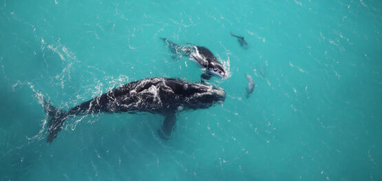
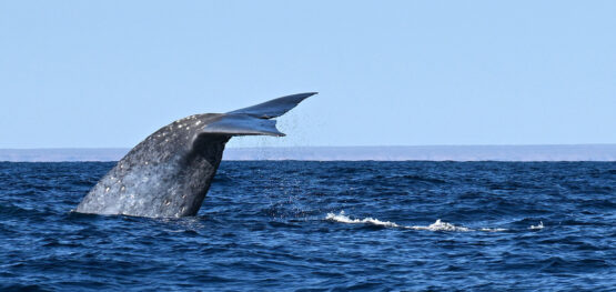
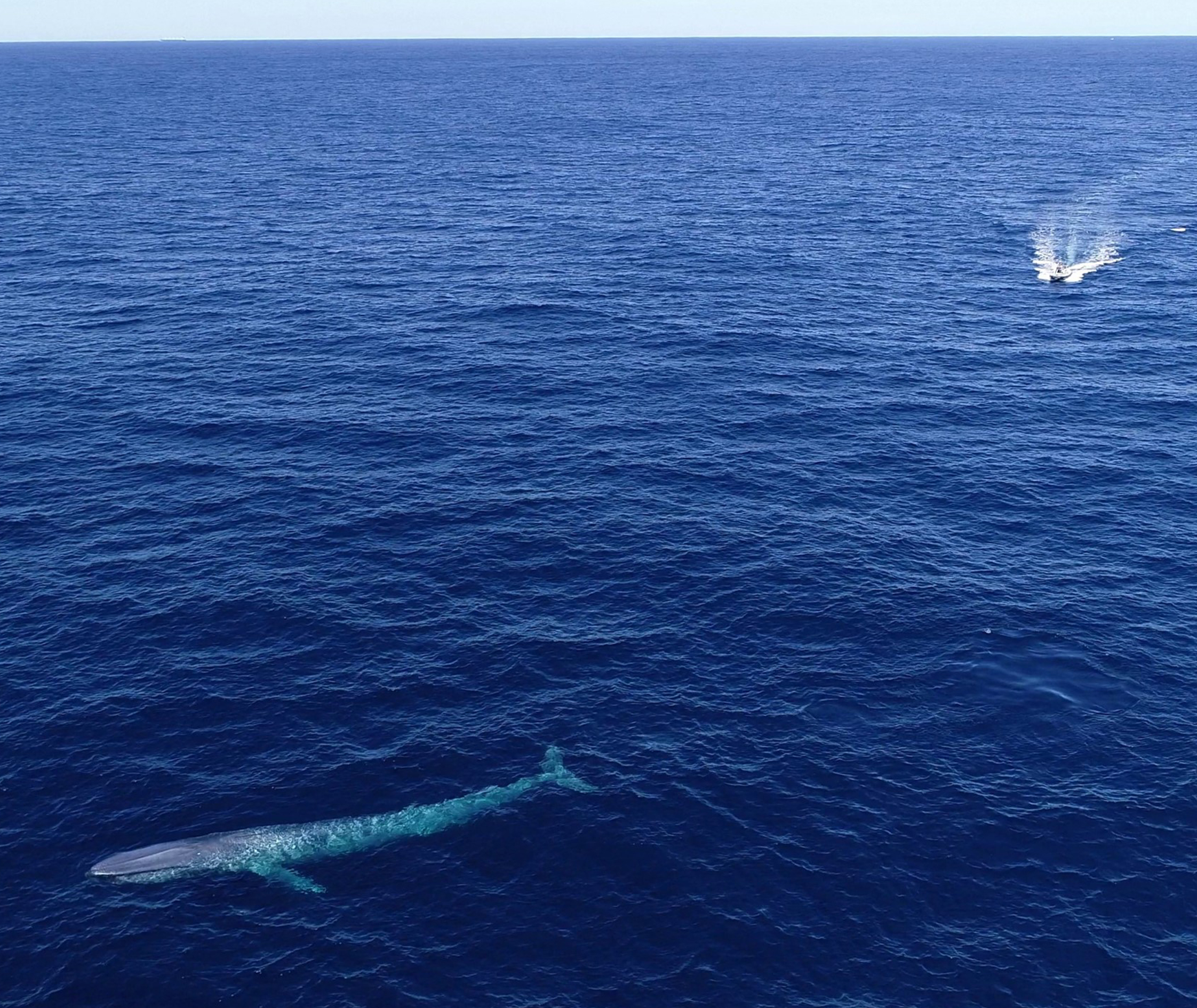 The project found a relatively low level of exposure to existing threats within the known pygmy blue whale distribution, but some caution is needed when using these results in decision-making. Additional data collection is needed, particularly from the whales' southern migration. Image: Grace Russell
 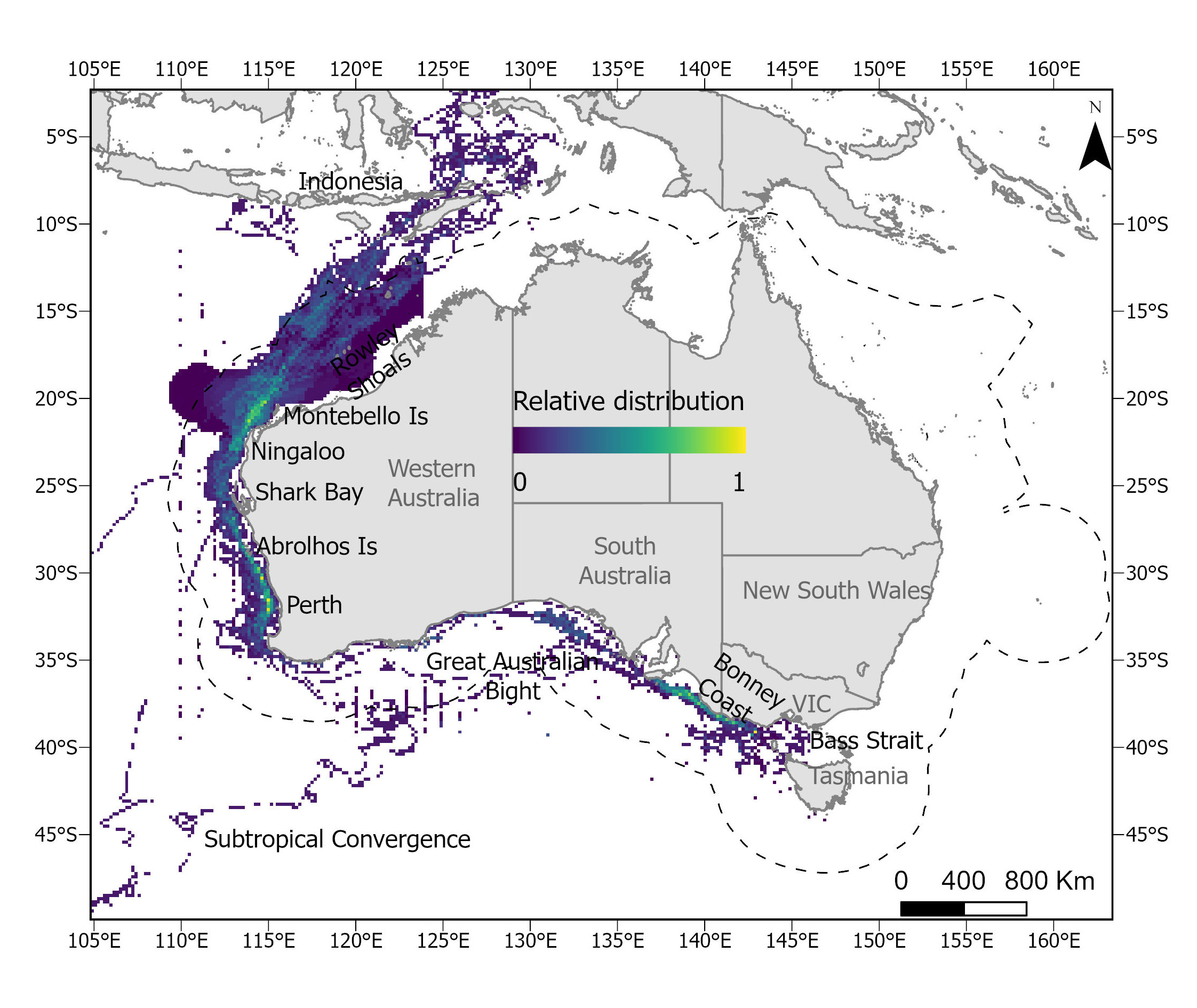 Relative pygmy blue whale combined distribution. The colour scale for relative distribution represents areas of higher (yellow), medium (green) and lower use (blue). Image: AIMS
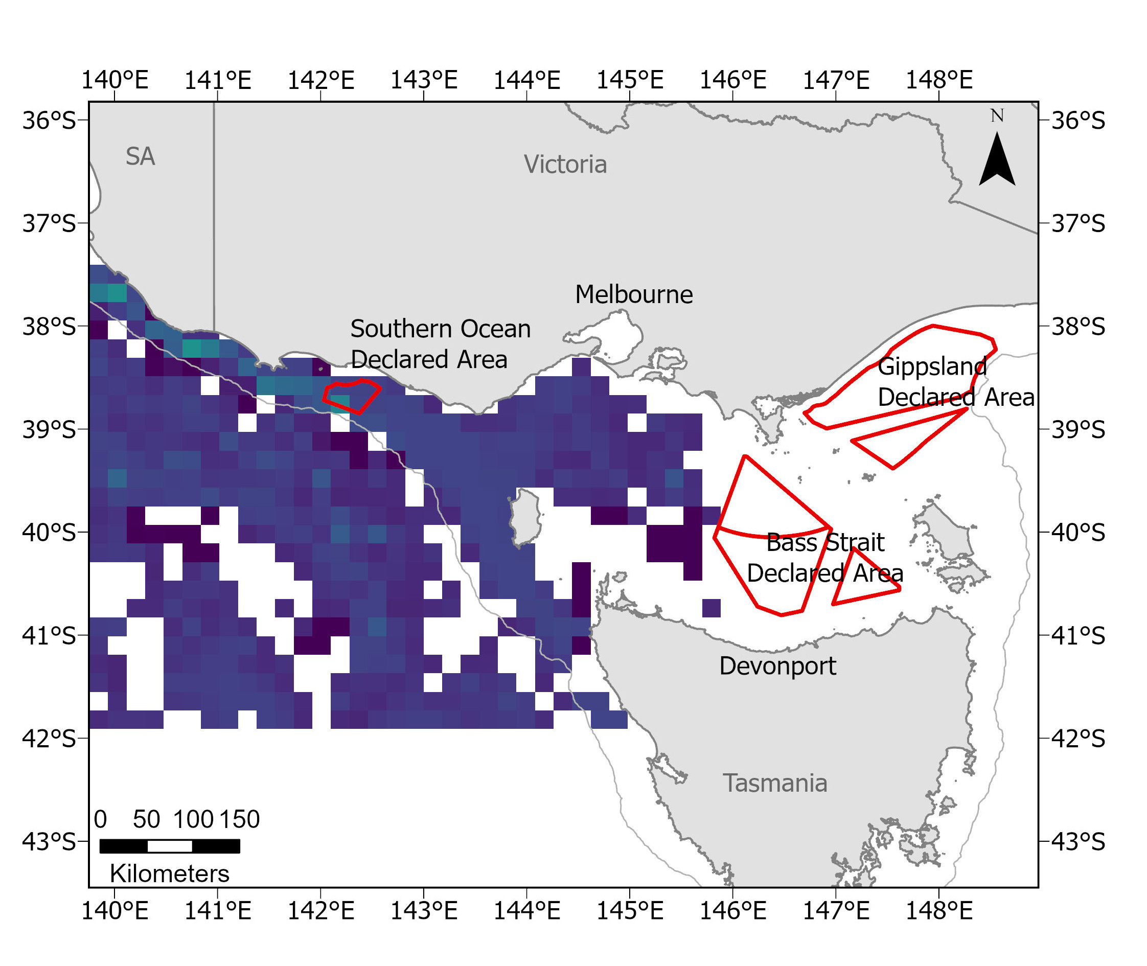 Pygmy blue whale combined foraging distribution zoomed into the offshore renewable energy declared areas off Victoria. Image: AIMS
New distribution maps
This project collated a range of spatial datasets available for pygmy blue whales in Australian waters and created 10-by-10-kilometre-resolution maps of relative distribution. The datasets were from previous studies, both published and unpublished, and included satellite telemetry; aerial, vessel and opportunistic surveys; catch records; and habitat suitability modelling. Foraging distribution was also mapped where behaviour data were available.
The updated distributions confirmed the importance of the Great South Australian Coastal Upwelling System, and areas in south-western and north-western Western Australia as important to foraging and migration. The monthly distributions, using tracking data only, confirmed a general route between feeding areas in temperate/subtropical latitudes to tropical waters. Most of the data was collected during the northern migration.
The limited southern migration data showed that some whales moved towards the Subtropical Convergence Zone. Although this area is outside Australian waters, it is significant to eastern Indian Ocean pygmy blue whale conservation.
Exposure to threats
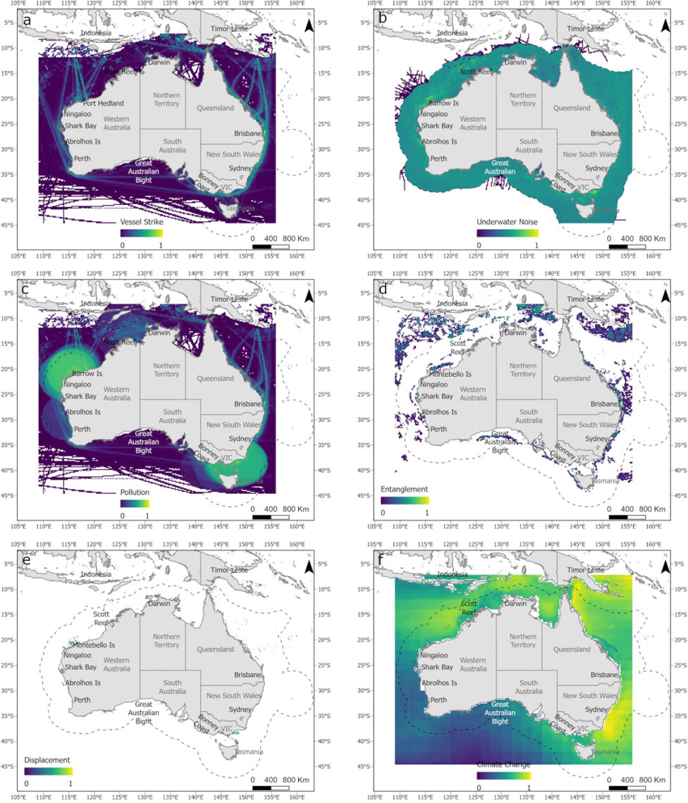
Spatial datasets were collated for 10 existing pressures associated with potential threats to pygmy blue whales. The threats of vessel strike, underwater noise, pollution, entanglement, displacement and climate change were mapped to identify where they overlap with pygmy blue whale distribution, as well as to understand the intensity and exposure of whales to the ‘cumulative’ threats.
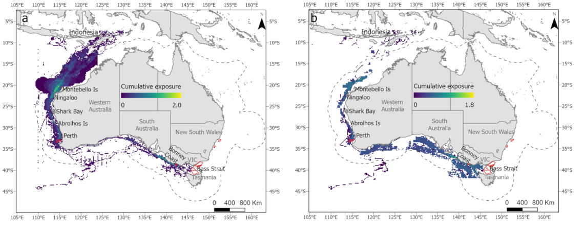
Most of these threats were distributed throughout Australian waters (particularly underwater noise, pollution, vessel strike and climate change). The exposure of pygmy blue whales to these threats, and to cumulative threats, was calculated by overlapping the distribution of threats (individual and cumulative) and the updated distribution for pygmy whales (foraging and entire distribution). This was done to map a continuum between high exposure (high intensity of threats overlapping with high intensity of whales) and low exposure (low intensity of threats overlapping with low intensity of whales).
Australian and international researchers and managers were then consulted to help determine the probability of pygmy blue whales being exposed to threats in areas where their distribution overlapped each pressure. This contributed to calculating the probability of exposure of pygmy blue whales to each pressure. The final result showed a relatively low level of exposure to existing threats within the known pygmy blue whale distribution.
Encouraging results
“Threat mapping is an important tool for the management of threatened species and habitats,” project co-leader Dr Luciana Ferreira of the Australian Institute of Marine Science (AIMS) says.
“Although the overlap between species distributions and threats does not infer an actual interaction and/or effect (and vice-versa), it can help to identify areas of conservation and management need.
“This is particularly true for threatened species where there is limited knowledge on impact and consequence of the interaction with human activities, such as pygmy blue whales.
“Additionally, cumulative exposure analysis and mapping can inform managers and regulators during decision-making by showing the current level of exposure within areas proposed for new developments.
“Our results are encouraging as they show Australia is in a privileged position to ensure the pygmy blue whale population is allowed to recover from historical whaling.”
Dr Luciana Ferreira, AIMS
More data needed
While the estimated level of exposure to existing threats is considered relatively low, some caution is needed when using these results in decision-making. There is a lack of spatial data in some areas where whales have been detected acoustically, an absence of empirical data on the probability of interactions between whales and pressures, and gaps in data for where pygmy blue whales go and when.
Additional data collection is needed for:
- the southern migration (most existing knowledge is from the northern migration);
- the whales' presence in south-western Western Australia, the Great Australian Bight, Bass Strait and the Subtropical Convergence; and
- the Bass Strait and Gippsland regions, where all threats and the highest cumulative threat intensity were observed, and are likely to increase when the construction of the offshore renewable energy industry begins.
For all blue whale subspecies and genetic stocks, satellite telemetry, structured surveys, and analysis of existing passive acoustic monitoring data are needed to determine movement and distribution patterns.
Existing spatial data need compiling to map probable occurrence, and behavioural and ecological studies are needed to understand potential effects of exposure to threats.
Spatial layers on Seamap
The new mapping is available as spatial layers on Seamap Australia.
Government and Industry can use these outputs for impact assessment and the management and recovery of pygmy blue whales. The mapping also supports decision-making by proponents about the need for further data on pygmy blue whales as part of their environmental planning.