There are hundreds of reefs and shoals in northern Australia’s coastal waters that support a vast array of marine creatures. Many remain unmapped as they are remote and difficult to see in the turbid, sediment rich waters typical of the region.
These un-mapped reefs can’t be considered for protection by planners when deciding how economic and other developments should proceed and be regulated.
This project addresses this problem by creating maps, and associated information, that show the location of the, as yet, unrecorded reefs, along with their habitat features.
Approach
The project will create new, more accurate maps of shallow reefs, using improved satellite imaging techniques. These provide a clearer view of the marine areas than has been achievable to-date. Components of the process include:
- a review of 30 years of satellite imagery for cloud-free images and clearer water occurrences;
- consideration of recent field data to refine geomorphic and benthic habitat maps; and
- improvement of the Allen Coral Atlas through new imagery and improved machine learning
The upgraded maps will provide higher levels of confidence to conservation and development planners, and thus ensure better outcomes for the protection of coral reefs.
Variation to Project 3.17 (February 2026)
This project has an approved variation that extends its scope.
The variation will focus on combining thousands of newly mapped reef boundaries from northern and western Australia with existing reef layers from the Coral Sea, Torres Strait and Great Barrier Reef. Together, these will form a single national-scale dataset for Australia’s tropical reefs. This work builds on more than 10,000 reef boundary features mapped earlier in the project.
This extension will:
-
improve the inshore Great Barrier Reef coral and rocky reef mapping to better integrate the GBR mapping into the national scale reef mapping dataset,
-
apply quality control to reduce mapping errors and ensure all features are classified using the National Vegetation Classification Level scheme, and
-
validate the dataset using existing field observations and a spatially balanced expert assessment to describe remaining uncertainties.
The aim is to create a robust, decision-ready dataset to support marine park planning, development assessments in northern Australia, environmental accounting, and marine research. The dataset will also support the statutory review of Australian Marine Park management plans in 2028, in collaboration with NESP Marine and Coastal project 5.6.
Expected outcomes
- Innovative and improved mapping techniques, analysis, and products.
- Reef protection enhanced through more accurate data being available to planners.
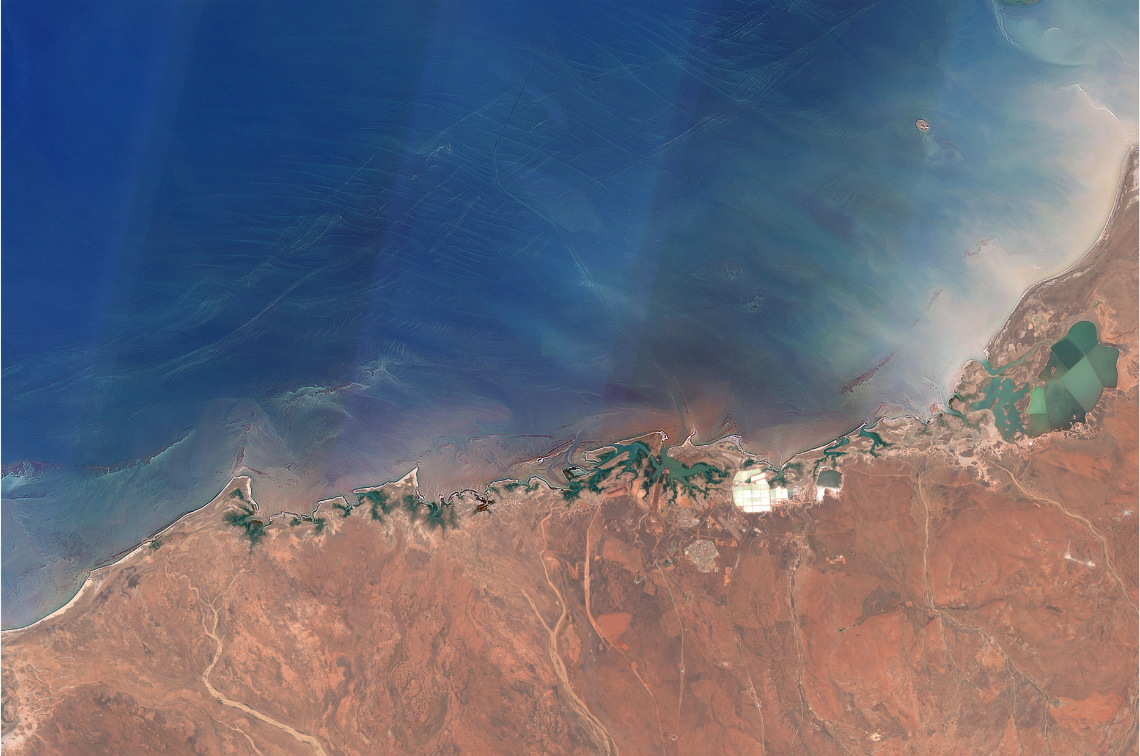 Ancient coastal reefs near Port Headland shown by Sentinel-2 satellite. Image: Chris Roelfsema
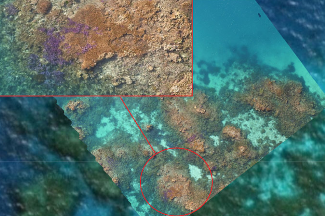 Orthomosasic image (highly-accurate, georeferenced, and seamless aerial image created by stitching together multiple, overlapping, high-resolution photographs taken by drones or aircraft) of Davies Reef. Image: Chris Roelfsema
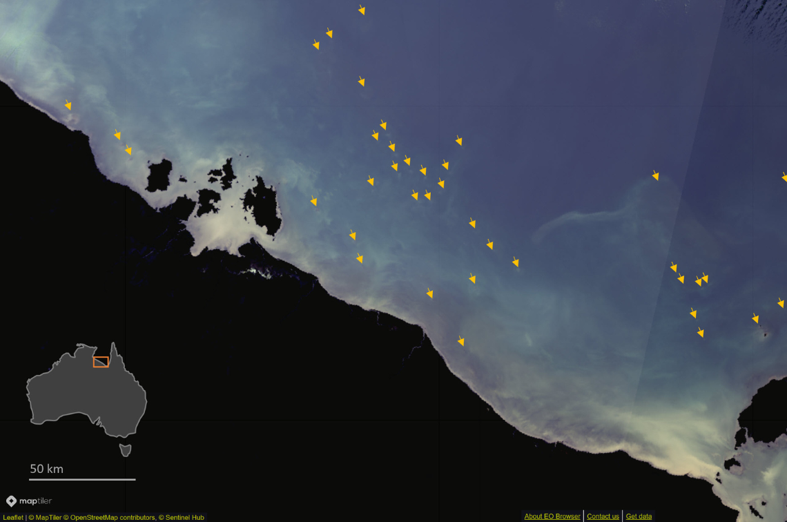 Many small reefs in the Gulf of Carpentaria shown by Sentinel-3 satellite. Image: Chris Roelfsema
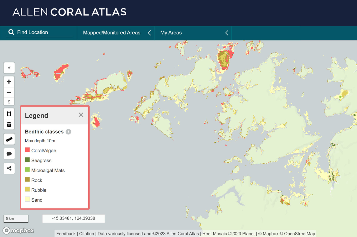 Existing Allen Atlas habitat mapping Augustus Island WA. Image: Chris Roelfsema
Project location
Project leaders
Research partners
Australian Institute of Marine Science
The University of Queensland
Research users
Department of Climate Change, Energy, the Environment and Water
Parks Australia